Page 51 - CLEARPOINT#3
P. 51

Our Services
                                                                    PROUDLY SERVICING AZ, FL, NJ, NY & PR


                                                                    Start Your Journey With Clearpoint
                                                                    Services LLC, Your Full Surveying
                                                                    & Mapping Company.

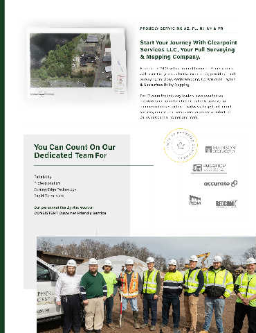
                                                                    Founded in 2005 with a team of Licensed Professionals,
                                                                    with over 100 years collective experience, providing Land                             TITLE SURVEYS
                                                                    Surveying Services, Aerial Mapping, Construction Layout                                      ALTA/ACSM Land
                                                                    & Subsurface Utility Mapping.                                                             Title Surveys
                                                                                                                                                                   Boundary Surveys
                                                                    For 17 years the industry leaders have counted on                                           FEMA Elevation Certificates
                                                                    our dedicated team for efficient, reliable surveys for                                      HUD Surveys
                                                                    commercial infrastructure, roadways, large tract parcel                                      Tidelands & Riparian Surveys
                                                                    surveys, educational campuses, corporate & industrial
                                                                    parks, residential homes and more.


                                                                                                                                                                                              LAND DEVELOPMENT
                                                                                                                                                                                                    Architectural Surveys
                 You Can Count On Our                                                                                                                                                               Bathymetric / Hydrographic Surveys
                                                                                                                                                                                                    Construction Layout
                 Dedicated Team For                                               1 0 0 ’ S   O F   S AT I S F I E D   C U S T O M E R S . .                                                        Engineering & Design Surveys
                                                                                                                                                                                                     Parcel Subdivisions
                                                                                  1 0 0 ’ S   O F   S AT I S F I E D   C U S T O M E R S
                                                                                                                                                                                                    Topographic Surveys

                 Reliability
                 Professionalism
                 Cutting Edge Technology                                                                                                                  AERIAL MAPPING
                 Rapid Turnaround                                                                                                                               Aerial photogrammetry
                                                                                                                                                                 Hyper-spectral Imaging
                 Our personnel live by this mantra:                                                                                                              Large tract data acquisition
                 CONSISTENT Customer Friendly Service                                                                                                            LiDAR Scanning & Mapping
                                                                                                                                                                Multispectral imaging
                                                                                                                                                                 Thermal Scanning & Imaging


                                                                                                                                                                                              SUBSURFACE UTILITY MAPPING
                                                                                                                                                                                              AND ENGINEERING (SUE)
                                                                                                                                                                                                   Advanced precision utility tracing
                                                                                                                                                                                                      Cemetery mapping (GPR)
                                                                                                                                                                                                    Concrete Scanning, for cables, high
                                                                                                                                                                                                   tension wires, rebars & Utilities
                                                                                                                                                                                                     Ground Penetrating  Radar (GPR)
   46   47   48   49   50   51   52