
Page 32 - Dr. Sachin's Environmental Project on Sacred Groves in Panhala Kolhapur
P. 32
Dr. Sachin Kondekar
Dr. Sachin Kondekar
Plate No. 3.8
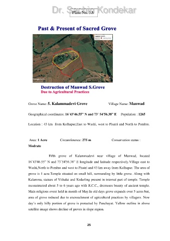
Grove Name: 5. Kalammadevi Grove Village Name: Manwad
Geographical coordinates: 16˚43'46.55” N and 73˚ 54'56.38” E Population : 1265
Location : 43 km from Kolhapur,East to Washi, west to Pisatri and North to Pombre.
Area: 1 Acre Circumference: 275 m Conservation status :
Modrate
Fifth grove of Kalammadevi near village of Manwad, located
16˚43'46.55” N and 73˚54'56.38” E longitude and latitude respectively.Village east to
Washi,North to Pombre and west to Pisatri and 43 km away from Kolhapur. The area of
grove is 1 acre.Temple situated on small hill, surrounding by little grove. Along with
Kalamma, statues of Vithalai and Kedarling present in internal part of temple. Temple
reconstructed about 5 to 6 years ago with R.C.C., decreases beauty of ancient temple.
Main religious event held in month of May.In old days grove expands over 5 acres but,
area of grove reduced due to encroachment of agricultural practices by villagers. Now
day’s only hilly portion of grove is protected by Panchayat. Yellow outline in above
satellite image shows decline of groves in slope region.
25