
Page 4 - Topographical Maps-Indroduction.pmd
P. 4
Practical Work in Geography
52
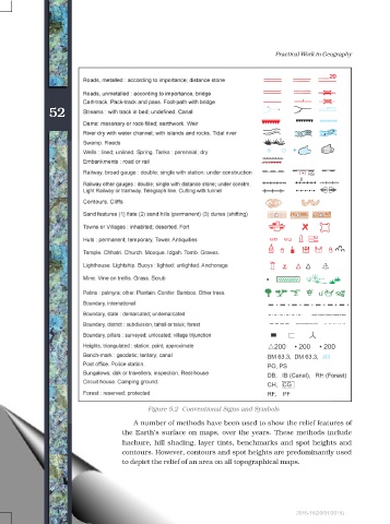
Figure 5.2 Conventional Signs and Symbols
A number of methods have been used to show the relief features of
the Earths surface on maps, over the years. These methods include
hachure, hill shading, layer tints, benchmarks and spot heights and
contours. However, contours and spot heights are predominantly used
to depict the relief of an area on all topographical maps.
2015-16(20/01/2015)