
Page 154 - (DK Eyewitness) Travel Guide - Australia
P. 154
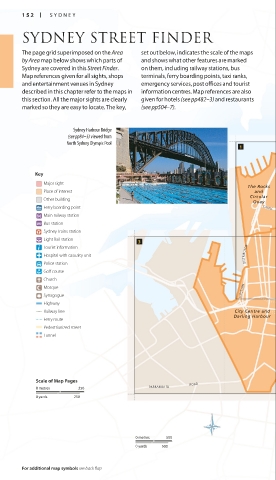
152 SY DNEY
SYDNEY STREET FINDER
The page grid superimposed on the Area set out below, indicates the scale of the maps
by Area map below shows which parts of and shows what other features are marked
Sydney are covered in this Street Finder. on them, including railway stations, bus
Map references given for all sights, shops terminals, ferry boarding points, taxi ranks,
and entertainment venues in Sydney emergency services, post offices and tourist
described in this chapter refer to the maps in information centres. Map references are also
this section. All the major sights are clearly given for hotels (see pp482–3) and restaurants
marked so they are easy to locate. The key, (see pp504–7).
Sydney Harbour Bridge
(see pp84–5) viewed from
North Sydney Olympic Pool
Key
Major sight
The Rocks
Place of interest and
Circular
Other building
Quay
Ferry boarding point CAH ILL
Main railway station
Bus station
Sydney Trains station
Light Rail station
Tourist information
Hospital with casualty unit DISTRIBUTOR
Police station
Golf course
Church
Mosque
Synagogue WESTERN
Highway
Railway line City Centre and
Darling Harbour
Ferry route
Pedestrianized street
Tunnel
Scale of Map Pages ROAD
0 metres 250 PARRAMATTA
0 yards 250
0 metres 500
0 yards 500
For additional map symbols see back flap