
Page 60 - The Rough Guide to Myanmar (Burma)
P. 60
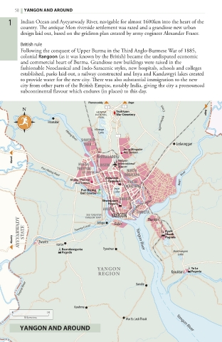
58  Yangon and around
    1   Indian Ocean and Ayeyarwady River, navigable for almost 1600km into the heart of the
        country. The antique Mon riverside settlement was razed and a grandiose new urban
        design laid out, based on the gridiron plan created by army engineer Alexander Fraser.
        British rule
        Following the conquest of Upper Burma in the Third Anglo-Burmese War of 1885,
        colonial Rangoon (as it was known by the British) became the undisputed economic
        and commercial heart of Burma. Grandiose new buildings were raised in the
        fashionable Neoclassical and Indo-Saracenic styles, new hospitals, schools and colleges
        established, parks laid out, a railway constructed and Inya and Kandawgyi lakes created
        to provide water for the new city. There was also substantial immigration to the new
        city from other parts of the British Empire, notably India, giving the city a pronounced
        subcontinental flavour which endures (in places) to this day.

                              Tharrawaddy  Bago
        N
                                 HLAWGA  Taukkyan                    Bago
                                NATIONAL  War Cemetery
                                 PARK                 Ngamoeyeik       Creek
                 Htantabin
                                Hlawga
                                 Lake
                            SHWEPYI
                       Hlaing River
                             THAR                          Ledaunggan
                                          Aung Mingalar
                                          Bus Station
     Mezali                      MINGALADON  Yangon
                           HLAING  INSEIN  International
                          THAR YAR      Airport NORTH
                             SEE ‘INSEIN’ MAP
                                          OKKALAPA
               Pun Hlaing River
                                    Kaba aye                Bago       River
                        Hlaing Thar Yar  Pagoda
                          Bus Station      SOUTH
                                          OKKALAPA
                            Pun Hlaing  Inya
                           golf Course  Lake
                                        BAHAN
                                   Shwedagon
                                     Pagoda
                                   AHLONE    Pazundaung Creek
                              SEE ‘GREATER  YANGON  THAKETA Thanlyin
                             YANGON’ MAP
       AYEYARWADY  STATE  Twante Canal                 Kyaik
                                 Seikgu
                                       Dalah
                                                       Khauk
     Maubin   Twante  Kanbe                   Yangon River  Pagoda
                     Baundawgyoke  Pyawbwe
                     Pagoda                               Banbwegon
                                                            Lake
                                 YANGON                         Ye Le
                                                                Pagoda
                                 REGION                  Kyauktan
       Twante River                           Danoke
                          Kawhmu
     0          10
         kilometres
                                          War Ba Lauk Thauk  Yangon River
        Yangon and around


   054-097_Myanmar_B2_Ch1.indd   58                            30/06/17   2:20 pm