
Page 145 - (DK Eyewitness) Travel Guide - Ireland
P. 145
SOUTHEAST IRELAND 143
q Wicklow by the road. Among the
Mountains numerous walking trails here
is Wicklow Way, the oldest
Road map D4. £ to Rathdrum & established walking route in
Wicklow. @ to Enniskerry, Wicklow, Ireland, which extends 132 km
Glendalough, Rathdrum & Avoca.
n Rialto House, Fitzwilliam Square, (82 miles) from Marlay Park in
Wicklow (0404 69117). Dublin to Clonegal in County
∑ discoverireland.ie/eastcoast Carlow. It is marked but not
always easy to follow, so do not
Standing amid the rugged set out without a decent map.
wilderness of the Wicklow Moun Although no peak exceeds
tains, it can be hard to believe 915 m (3,000 ft), the Wicklow
that Dublin is under an hour’s Mountains can be dangerous
drive away. The inaccessibility of in bad weather.
the mountains meant that they Hiking apart, there is plenty
once provided a safe hideout to see and do in this region.
for opponents of English rule. A good starting point for
When much of the southeast exploring the northern area is Mount Usher Gardens, on the banks
was obedient to the English the estate village of Enniskerry. of the River Vartry
Crown, within an area known as In summer, it is busy with tourists
the Pale (see p136), warlords such who come to visit the gardens the hamlet of Avoca, where the
as the O’Tooles ruled in the at Powerscourt (see pp138–9). Avoca Handweavers produce
Wicklow Mountains. Rebels who From Laragh, to the south, you colourful tweeds in the oldest
took part in the 1798 uprising can reach Glendalough (see handweaving mill in Ireland,
(see p45) sought pp144–5) and the in operation since 1723.
refuge here too. Vale of Avoca, Further north, towards the
One of their where cherry trees coast near Ashford, the River
leaders, Michael are laden with Vartry rushes through the deep
Dwyer, remained blossom in the chasm of the Devil’s Glen. On
at liberty in the spring. The beauty entering the valley, the river falls
hills around Sally of this gentle 30 m (100 ft) into a pool known
Gap until 1803. valley was as the Devil’s Punchbowl. There
The building of captured in the are good walks around here,
the Military Road, Road sign in the Wicklow Mountains poetry of Thomas with fine views of the coast.
started in 1800, Moore (1779–
made the area more accessible, 1852): “There is not in the wide = Avoca Handweavers
but the mountains are still thinly world a valley so sweet as that Avoca. Tel 0402 35105. Open 9am–
populated. There is little traffic vale in whose bosom the bright 6pm daily. Closed 25 & 26 Dec. 0 =
to disturb enjoyment of the waters meet” – a reference to ∑ avoca.ie
beautiful rockstrewn glens, the confluence of the Avonbeg
lush forest and bogland where and Avonmore rivers, the
heather gives a purple sheen to socalled Meeting of the Waters w Mount Usher
the land. Turfcutting is still a beyond Avondale House (see Gardens
thriving cottage industry, and p145). Nestled among wooded
you often see peat stacked up hills at the heart of the valley is Road map D4. Ashford, Co Wicklow.
Tel 0404 40205. @ to Ashford.
Open 10am–6pm daily. & = -
7 limited. 8 call to book.
∑ mountushergardens.ie
Set beside the River Vartry
just east of Ashford are the
Mount Usher Gardens. They
were designed in 1868 by a
Dubliner, Edward Walpole, who
imbued them with his strong
sense of romanticism.
The gardens contain more than
5,000 species of shrubs and
trees, from Chinese conifers and
bamboos to Mexican pines. The
Maple Walk is glorious in autumn.
The river provides the main
focus, and amid the vegeta tion
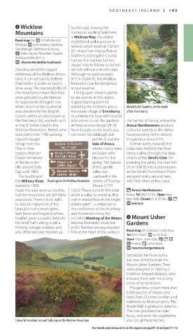
Colourful moorland around Sally Gap in the Wicklow Mountains you can glimpse herons.
For hotels and restaurants in this region see pp297–8 and pp311–13
142-143_EW_Ireland.indd 143 08/03/17 11:06 am