
Page 292 - (DK Eyewitness) Travel Guide 2017 - Alaska
P. 292
290 SUR VIV AL GUIDE
The Alaska Highway Driving the Alaska
Highway
For many drivers, the Alaska Highway – formerly called The Alaska Highway has long
the Alcan, short for the Alaska-Canada Highway – is the had a reputation for challeng
adventure of a lifetime. Crossing some of the wildest territory ing road conditions, but over
in the world, every stretch of this 1,390-mile (2,224-km) road time, the conditions have
improved. The entire two
offers breathtaking sights and experiences. Starting in Dawson lane high way is now paved or
Creek in Canada’s British Columbia, it crosses remote ranges, chipsealed, and is also shorter
running through taiga forests and past crystalline lakes into than it originally was, with at
the Yukon Territory. At Haines Junction, drivers can take the least 35 miles (56 km) of the
Haines Cut-Off (see p154) to Southeast Alaska, or continue historical route having been
cut off due to rerouting and
northwest through Canada’s strikingly lovely Kluane straightening. It is still a long
National Park. For the next 200 miles (320 km), it crosses trip, however, and the roadside
scenic mountain country to the US-Canada border, and scenery is so fabu lous that it
continues northwest past the Alaskan gate way town of is worth allowing extra time
Tok for its final stretch to Fairbanks. for sightseeing.
Despite these improvements,
some parts of the highway
still suffer from serious cracks,
frost heaves, and potholes, and
every summer, long stretches
of the road undergo extensive
construc tion and repair,
which can significantly slow
drivers’ progress. The roughest,
most frostheaved portion is
between Canada’s Kluane Lake
and the Alaskan border, while
the most serious grades and
turns are found between
Dawson Creek and Watson
Lake in Canada. Information
on highway conditions can be
obtained from Drive British
Columbia, Yukon Daily Road
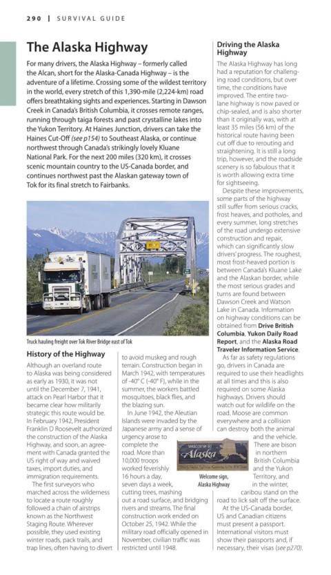
Truck hauling freight over Tok River Bridge east of Tok Report, and the Alaska Road
Traveler Information Service.
History of the Highway
to avoid muskeg and rough As far as safety regulations
Although an overland route terrain. Construction began in go, drivers in Canada are
to Alaska was being considered March 1942, with temperatures required to use their head lights
as early as 1930, it was not of 40° C (40° F), while in the at all times and this is also
until the December 7, 1941, summer, the work ers battled required on some Alaska
attack on Pearl Harbor that it mosquitoes, black flies, and highways. Drivers should
became clear how militarily the blazing sun. watch out for wildlife on the
strategic this route would be. In June 1942, the Aleutian road. Moose are common
In February 1942, President Islands were invaded by the every where and a collision
Franklin D Roosevelt autho rized Japanese army and a sense of can destroy both the ani mal
the construction of the Alaska urgency arose to and the vehicle.
Highway, and soon, an agree complete the There are bison
ment with Canada granted the road. More than in northern
US right of way and waived 10,000 troops British Columbia
taxes, import duties, and worked fever ishly and the Yukon
immigration requirements. 16 hours a day, Welcome sign, Territory, and
The first surveyors who seven days a week, Alaska Highway in the winter,
marched across the wilder ness cutting trees, mashing cari bou stand on the
to locate a route roughly out a road surface, and bridging road to lick salt off the surface.
followed a chain of airstrips rivers and streams. The final At the USCanada border,
known as the Northwest construc tion work ended on US and Canadian citi zens
Staging Route. Wherever October 25, 1942. While the must present a passport.
possible, they used existing military road officially opened in International visi tors must
winter roads, pack trails, and November, civilian traffic was show their pass ports and, if
trap lines, often having to divert restricted until 1948. necessary, their visas (see p270).
290-291_EW_Alaska.indd 290 02/05/17 2:33 pm