
Page 240 - (DK Eyewitness) Travel Guide - Sydney
P. 240
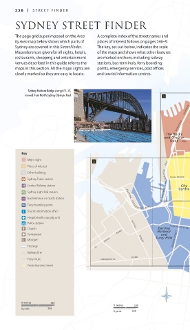
238 STREE T FINDER
SYDNEY STREET FINDER
The page grid superimposed on the Area A complete index of the street names and
by Area map below shows which parts of places of interest follows on pages 246–9.
Sydney are covered in this Street Finder. The key, set out below, indicates the scale
Map references given for all sights, hotels, of the maps and shows what other features
restaurants, shopping and entertainment are marked on them, including railway
venues described in this guide refer to the stations, bus terminals, ferry boarding
maps in this section. All the major sights are points, emergency services, post offices
clearly marked so they are easy to locate. and tourist information centres.
Sydney Harbour Bridge (see pp72–3),
viewed from North Sydney Olympic Pool
HIGHWAY SYDNEY
BRADFIELD HARBOUR
The Rocks TUNNEL
and Circular
Quay C AHILL
EXPRESSWAY
Key
Botanic
Garden and
Major sight The Domain
Place of interest
Other building
Sydney Trains station WESTERN DIS T RIBUTOR FWY KING STREET
Central Railway station Centre
City
Sydney Light Rail station Kings Cross and
Darlinghurst
Bus terminus or coach station WESTERN DISTR I B U TOR FWY
Ferry boarding point PARK STREET WILLIAM
STREET
Tourist information office
NEW
Hospital with casualty unit SOUTH
Police station WATTLE HE A D
ROAD
Darling
Church Harbour GOULBURN STREET
Synagogue ROAD and
Mosque JOHNS STREET Surry Hills GEORGE STREET
Freeway ST
Railway line
Ferry route PARRAMATTA ROAD O X F O R D S T R E E T
Pedestrianized street
Paddington
STREET MOORE PARK
DOWLING ANZAC ROAD OXFORD STREET
0 metres 250 PARADE
0 metres 500 SOUTH
0 yards 250
0 yards 500
238-239_EW_Sydney.indd 238 11/07/2017 12:52