
Page 111 - Social Studies 5
P. 111
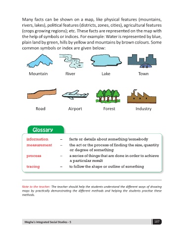
Many facts can be shown on a map, like physical features (mountains,
              rivers, lakes), political features (districts, zones, cities), agricultural features
              (crops growing regions); etc. These facts are represented on the map with
              the help of symbols or indices. For example: Water is represented by blue,
              plain land by green, hills by yellow and mountains by brown colours. Some
              common symbols or index are given below:


                  Mountain              River                Lake                  Town


                      Road               Airport              Forest             Industry


                    Glossary


                 information        –     facts or details about something/somebody
                 measurement        –     the act or the process of finding the size, quantity
                                          or degree of something
                 process            –     a series of things that are done in order to achieve
                                          a particular result
                 tracing            –     to follow the shape or outline of something


              Note to the teacher: The teacher should help the students understand the different ways of drawing
              maps  by  practically  demonstrating  the  different  methods  and  helping  the  students  practise  these
              methods.


                Megha's Integrated Social Studies - 5                                       107