
Page 42 - GeoPRISMS_Newsletter_Spring2018_Neat
P. 42
Early-Career Scientists/Faculty:
Introduction to GeoPRISMS/MARGINS data resources,
mini-Lessons, and effective broader impacts
Conveners: Andrew Goodwillie (Lamont-IEDA), Julia Morgan (Rice University)
Early-career members of the GeoPRISMS community including and balanced suite of learning modules that highlights key results
graduate students, post-docs and recently-appointed faculty of the MARGINS program, as well as some early results of the
often seek help in three areas: in generating ideas for successful GeoPRISMS SCD and of RIE initiatives. The mini-lessons enable
broader impacts, in finding reliable sources of material for their data-rich learning opportunities for upper-level undergraduate
class exercises, and in locating effective data tools relevant for their students and provide a valuable resource to educators interested in
research and teaching. This workshop aimed to provide guidance and continental margins research. Juli Morgan discussed the Rift Basin
pointers on these topics, and aimed to show how the GeoPRISMS- Morphology module as an example of bringing RCL science into the
hosted MARGINS mini-lessons could be used as a vehicle to explore classroom. Eliza Richardson and Jeff Marshall summarized SEIZE
each aspect. initiative mini-lesson modules covering Slow-Slip Events. Bob Stern
Following an introduction by GeoPRISMS Office chair Demian and Jeff Ryan described SubFac modules that tackle active tectonics
Saffer, this half-day workshop proceeded with demonstrations from and geochemical studies at the Marianas and Central America
the NSF-funded IRIS, UNAVCO and IEDA data facilities of data subduction systems.
tools and resources that are relevant for GeoPRISMS. The final part of the workshop was a round-table discussion of
John Taber, IRIS director of education and public outreach, strategies to improve the impact and effectiveness of proposed
presented IRIS data tools including Seismic Monitor (http:// Broader Impacts, with a focus on the generation of community
ds.iris.edu/seismon/) which displays near real-time earthquake accessible mini-lessons and data sets.
information, the Earthquake Teachable Moments slide packets More than thirty participants from a range of fields registered for
(https://www.iris.edu/hq/retm/), IRIS Ground Motion Visualization the event. The conveners thank GeoPRISMS for arranging this mini-
GMV animations (http://ds.iris.edu/ds/products/gmv/), the IRIS workshop at the Fall AGU meeting.
3-D Earthquake Browser (http://ds.iris.edu/ieb/), a seismic wave
propagation visualization tool (http://ds.iris.edu/seismon/swaves/),
and the jAmaSeis realtime seismic data display (https://www.iris.
edu/hq/inclass/software-web-app/jamaseis).
UNAVCO’s Shelley Olds described the Short Courses for advancing
technical expertise which cover topics including GPS and InSAR data
processing, and Terrestrial Laser Scanning (https://www.unavco.org/
education/professional-development/short-courses/2018/2018.html).
The GETSI peer-reviewed teaching modules were shown (https://
serc.carleton.edu/getsi/index.html). Her presentation also provided Photos by A. Férot
a demonstration of the GPS Velocity Viewer web interface (https://
www.unavco.org/software/visualization/GPS-Velocity-Viewer/
GPS-Velocity-Viewer.html).
Andrew Goodwillie from the IEDA facility demonstrated the NSF
Data Management Plan Tool (Data Search using EarthChem (http://
www.earthchem.org/portal) and MGDS (http://www.marine-geo.
org/tools/new_search/search_map.php), and the GeoMapApp data
discovery and visualization tool (http://www.geomapapp.org/).
Former GeoPRISMS Office chair and lead PI on the MARGINS
mini-lessons project Juli Morgan introduced the rationale behind the
mini-lesson modules (http://geoprisms.org/education/mini-lessons/). Photos by A. Férot
They were designed to integrate in undergraduate geoscience
curricula the critical new MARGINS observations and insights
of fundamental geological processes along continental margins.
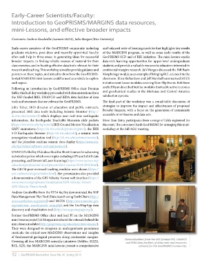
Covering all four MARGINS scientific initiatives (SubFac, SEIZE, Demonstrations from the NSF-funded IRIS, UNAVCO
and IEDA data facilities of data tools and resources
RCL, S2S), the MARGINS mini-lessons present a comprehensive relevant for the GeoPRISMS Community.
42 • GeoPRISMS Newsletter Issue No. 40 Spring 2018