
Page 210 - (DK Eyewitness) Travel Guide - Ireland
P. 210
208 IRELAND REGION B Y REGION
1 Céide Fields materials, complementing their
surroun dings. They aim to
Road map B2. 8 km (5 miles) W of
Ballycastle, Co Mayo. Tel 096 43325. highlight the coast’s grandeur
Open Apr–end Oct: daily. & 8 - and enduring nature. Temporary
7 ∑ heritageireland.ie exhibits also feature.
Surrounded by heather-clad
moorlands and mountains along 2 Achill Island
a bleak, dramatic stretch of Road map A3. Co Mayo. * 3,000.
north Mayo coastline is Europe’s @ from Westport. n 098 20705.
largest Stone Age monument. ∑ achilltourism.com
Over 10 sq km (4 sq miles)
were enclosed by walls to Ireland’s largest island, 22 km
make fields suitable for growing (13.5 miles) long and 19 km The Angel of Welcome above the marble
wheat and barley, and grazing (12 miles) wide, is reached by a staircase at Westport House
cattle. Remains of farm buildings road bridge that can be raised for
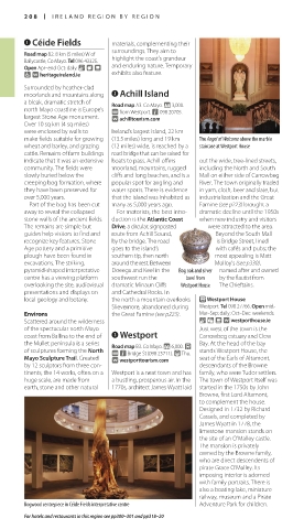
indicate that it was an extensive boats to pass. Achill offers out the wide, tree-lined streets,
community. The fields were moorland, moun tains, rugged including the North and South
slowly buried below the cliffs and long beaches, and is a Mall on either side of Carrow beg
creeping bog forma tion, where popular spot for angling and River. The town originally traded
they have been preserved for water sports. There is evidence in yarn, cloth, beer and slate, but
over 5,000 years. that the island was inhabited as industrialization and the Great
Part of the bog has been cut many as 5,000 years ago. Famine (see p223) brought a
away to reveal the collapsed For motorists, the best intro- dramatic decline until the 1950s
stone walls of the ancient fields. duction is the Atlantic Coast when new industry and visitors
The remains are simple but Drive, a circular, sign posted were attracted to the area.
guides help visitors to find and route from Achill Sound, Beyond the South Mall
recognize key features. Stone by the bridge. The road is Bridge Street, lined
Age pottery and a primitive goes to the island’s with cafés and pubs; the
plough have been found in southern tip, then north most appealing is Matt
excavations. The striking, around the rest. Between Molloy’s (see p330),
pyramid-shaped interpretative Doeega and Keel in the Bog oak and silver named after and owned
centre has a viewing platform southwest run the bowl from by the flautist from
overlooking the site, audiovisual dramatic Minaun Cliffs Westport House The Chieftains.
presentations and displays on and Cathedral Rocks. In
local geology and botany. the north a mountain overlooks P Westport House
Slievemore, abandoned during Westport. Tel 098 27766. Open mid-
Environs the Great Famine (see p223). Mar–Sep: daily; Oct–Dec: weekends.
Scattered around the wilder ness & = - ∑ westporthouse.ie
of the spectacular north Mayo Just west of the town is the
coast from Ballina to the end of 3 Westport Carrowbeg estuary and Clew
the Mullet peninsula is a series Road map B3. Co Mayo. * 6,000. £ Bay. At the head of the bay
of sculptures forming the North @ n Bridge St (098 25711). ( Thu. stands Westport House, the
Mayo Sculpture Trail. Created ∑ westporttourism.com seat of the Earls of Altamont,
by 12 sculptors from three con- descendants of the Browne
tinents, the 14 works, often on a Westport is a neat town and has family, who were Tudor settlers.
huge scale, are made from a bustling, prosperous air. In the The town of Westport itself was
earth, stone and other natural 1770s, architect James Wyatt laid started in the 1750s by John
Browne, first Lord Altamont,
to complement the house.
Designed in 1732 by Richard
Cassels, and completed by
James Wyatt in 1778, the
limestone mansion stands on
the site of an O’Malley castle.
The mansion is privately
owned by the Browne family,
who are direct descendents of
pirate Grace O’Malley. Its
imposing interior is adorned
with family portraits. There is
also a boating lake, miniature
railway, museum and a Pirate
Bogwood centrepiece in Céide Fields interpretative centre Adventure Park for children.
For hotels and restaurants in this region see pp300–301 and pp318–20
208-209_EW_Ireland.indd 208 08/03/17 11:07 am
Eyewitness Travel LAYERS PRINTED:
Catalogue template “UK” LAYER
(Source v1.9)
Date 20th August 2012
Size 125mm x 217mm