
Page 212 - (DK Eyewitness) Travel Guide - Ireland
P. 212
210 IRELAND REGION B Y REGION
8 Clare Island
Road map A3. Co Mayo. * 130.
g from Roonagh Quay, 6.5 km (4
miles) W of Louisburgh. Tel 098 23737
or 086 851 5003 (ferry services).
n Westport (098 25711).
∑ clareisland.ie
Clare Island is dominated by two
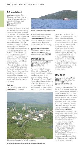
hills, and a square 15th-century The ferry to Inishbofin leaving Cleggan Harbour
castle com mands the headland
and har bour. In the 16th century Atlantic landscape, sheltered castle, occupied in the 16th
the island was the stronghold of coves and sea angling. The century by Spanish pirate Don
Grace O’Malley, pirate queen Granuaile Centre tells the story Bosco in alliance with Grace
and patriot, who held sway over of Grace O’Malley (Granuaile in O’Malley. In 1653 it was captured
the western coast. Although, Gaelic) and has displays on by Cromwellian forces and used
according to Tudor state papers, Mayo folklore and archaeology. as a prison for Catholic priests.
she was received at Queen Inishbofin was later owned
Elizabeth I’s court, she stood out E Granuaile Visitor Centre by a succession of absentee
against English rule until her St Catherine’s Church, Louisburgh. landlords and now survives
death in her seventies in 1603. Tel 098 66341. Open Mon–Fri, on farming and lobster fishing.
She is buried here in a tiny weekends by appt only. & = 7 Surrounded by reefs and
Cistercian abbey decorated with islets, the island’s landscape is
medieval murals and inscribed 9 Inishbofin characterized by stone walls,
with her motto: “Invincible on Road map A3. Co Galway. * 200. reed-fringed lakes and hay
land and on sea”. g from Cleggan (095 45819). meadows, where the corn crake
The island is dotted with Iron n Clifden (095 21163). (see p22) can be seen, or heard.
Age huts and field systems as Inishbofin’s beaches offer
well as promontory forts and The name Inishbofin means bracing walks.
Bronze Age cooking sites. Clare “island of the white cow”. This
Island is rich in bog flora and mysterious, often mist-swathed
fauna, making it popular with island was chosen for its 0 Clifden
walkers. Animal lovers come to remoteness by the exiled Road map A3. Co Galway. * 920.
see the seals, dolphins, falcons 7th-century St Colman, English @ n Mar–end Sep: Galway Road
and otters. Abbot of Lindisfarne. On the site (095 21163). ( Tue & Fri.
of his original monastery is a ∑ discoverireland.ie/west
Environs late medieval church, graveyard
The mainland coastal town of and holy well. At the sheltered Framed by the grandeur of the
Louisburgh offers rugged harbour entrance lies a ruined Twelve Bens mountain range and
with a striking skyline dom inated
by two church spires, this early
19th-century market town passes
for the capital of the Connemara
region and is a good base for
exploring. Clifden was founded
in 1812 by John d’Arcy, a local
landowner and High Sheriff of
Galway, to create a pocket of
respectability within the
lawlessness of Connemara. The
family eventually went bankrupt
trying to bring pros perity and
order to the town. The Protestant
church contains a copy of
the Cross of Cong (see p71).
Today craft shops have
taken over much of the town.
In the centre is the Square, a
place for lively pubs such as
E J Kings (see p329). Connemara
is noted for its sean nós
(unaccompanied singing), but
in Clifden, generally traditional
Clifden against a backdrop of the Twelve Bens mountains music is more common.
For hotels and restaurants in this region see pp300–301 and pp318–20
210-211_EW_Ireland.indd 210 08/03/17 11:07 am
Eyewitness Travel LAYERS PRINTED:
Catalogue template “UK” LAYER
(Source v1.9)
Date 20th August 2012
Size 125mm x 217mm