
Page 79 - (DK Eyewitness) Travel Guide - Ireland
P. 79
DUBLIN AREA B Y AREA 77
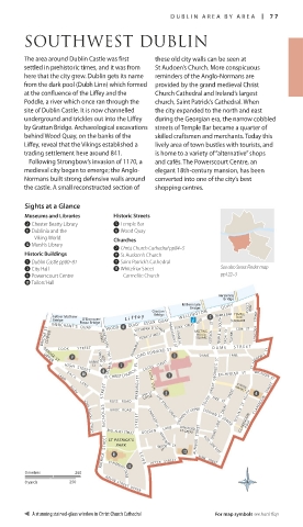
SOUTHWEST DUBLIN
The area around Dublin Castle was first these old city walls can be seen at
settled in prehistoric times, and it was from St Audoen’s Church. More conspicuous
here that the city grew. Dublin gets its name reminders of the Anglo-Normans are
from the dark pool (Dubh Linn) which formed provided by the grand medieval Christ
at the confluence of the Liffey and the Church Cathedral and Ireland’s largest
Poddle, a river which once ran through the church, Saint Patrick’s Cathedral. When
site of Dublin Castle. It is now channelled the city expanded to the north and east
underground and trickles out into the Liffey during the Georgian era, the narrow cobbled
by Grattan Bridge. Archaeological excavations streets of Temple Bar became a quarter of
behind Wood Quay, on the banks of the skilled craftsmen and merchants. Today this
Liffey, reveal that the Vikings established a lively area of town bustles with tourists, and
trading settlement here around 841. is home to a variety of “alternative” shops
Following Strongbow’s invasion of 1170, a and cafés. The Powerscourt Centre, an
medieval city began to emerge; the Anglo- elegant 18th-century mansion, has been
Normans built strong defen sive walls around converted into one of the city’s best
the castle. A small reconstructed section of shopping centres.
Sights at a Glance
Museums and Libraries Historic Streets
2 Chester Beatty Library 5 Temple Bar
8 Dublinia and the 6 Wood Quay
Viking World Churches
w Marsh’s Library
7 Christ Church Cathedral pp84–5
Historic Buildings 9 St Audoen’s Church
1 Dublin Castle pp80–81 q Saint Patrick’s Cathedral
3 City Hall e Whitefriar Street See also Street Finder map
4 Powerscourt Centre Carmelite Church pp122–3
0 Tailors’ Hall
Ha'penny
Bridge
Millennium
Bridge
Grattan WELL INGTON QU AY ASDILL'S ROW
Father Mathew L i f f e y Bridge TEMPLE BAR TEMPLE
BAR
Bridge O'Donovan ST SQUARE
Rossa Bridge ESSEX QUAY
MERCHANT’S QUAY WOOD QUAY ESSEX STREET EAST TEMPLE LA SOUTH COPE ST ANGLESEA STREET
BRIDGE ST LOWER STREET WINETAVERN ESSEX ST WEST PARLIAMENT ST CRANE LA MEETING- EUSTACE ST CROW ST FOWNES
HOUSE
SQUARE
LORD EDWARD ST
COOK S T REE T FISHAMBLE ST EXCHANGE ST LOWER D A M E S T R E E T
LANE
BRIDGE ST
UPPER
BORRIS ST MICHAEL’S CLOSE DAME ST AN DREW’S ST
CT ST MICHAEL ’ S HILL CHRISTCHURCH PL CASTLE STRE E T SOUTH GREAT GEORGE’S ST EXCHEQUER ST WICKLOW ST
HIGH STREET
B A C K
LAMB
NI CH O L A S STR E E T ROSS ROAD WERBURGH ST SHIP ST CHANCERY LA SHIP STREET GREAT FADE ST DRURY STREET MARKET CLARENDON STREET
L A N E
CASTLE
WILLIAM ST SOUTH
CASTLE STEPS
ALLEY
LITTLE
BRIDE ROAD
LANE
STREET
LANE
LONGFORD
DIGGES
BULL ALLEY STREET GOLDEN WHITEF RIAR ST STEPHEN ST UPPER STEPHEN ST LOWER CLARENDON ROW
ST GREAT
JOHN DILLON STREET
PATRICK S TREET PARK B R I D E S T R E E T WOOD AUNGIER YORK STREET
ST PATRICK'S
ST
BOW LANE EAST
0 metres 250 ST PATRICK’S CLOSE PE T E R ST R E E T
0 yards 250 KEVIN STREET UPPER
A stunning stained-glass window in Christ Church Cathedral For map symbols see back flap
IR_076-077_Dub_SW_Int.indd 77 25/04/16 11:01 am