
Page 313 - (DK Eyewitness) Travel Guide - Italy
P. 313
FL ORENCE 311
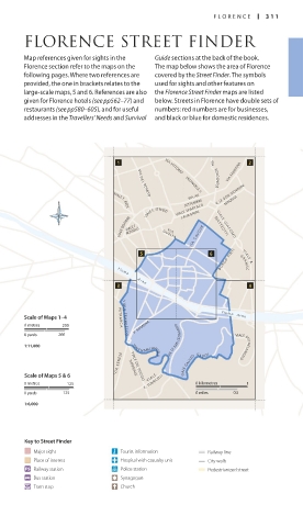
FLORENCE STREET FINDER
Map references given for sights in the Guide sections at the back of the book.
Florence section refer to the maps on the The map below shows the area of Florence
following pages. Where two references are covered by the Street Finder. The symbols
provided, the one in brackets relates to the used for sights and other features on
large-scale maps, 5 and 6. References are also the Florence Street Finder maps are listed
given for Florence hotels (see pp562–77) and below. Streets in Florence have double sets of
restaurants (see pp580–605), and for useful numbers: red numbers are for businesses,
addresses in the Travellers’ Needs and Survival and black or blue for domestic residences.
VIA FAENTINA
VIA VITTORIO
VIA BOLOGNESE
EMANUELE II
VIA XX V. LE DON GIOVANNI
VIA D E L ROMITO
SETTEMBRE MINZONI
VIALE SPARTACO
VIALE F. REDI
VIALE F. STROZZI LAVAGNINI
VIALE BELFIORE VIALE F. G U E L FA V I A C AV O U R M A T T E O T T I
ROSSELLI
V I A
V I A L E G I A C O M O
B O R G O P I N T I GRAMS C I
V I A L E A.
F i u m e
A r n o
Scale of Maps 1–4 P E T R A R C A V I A L E F R A N C E S C O F i u m e A r n o
V. ROMANA
0 metres 200
0 yards 200
1:11,000 VIALE N.MACHIA VELLI VIE DI SAN LEON ARDO VIALE MICHELANGELO
V I A S E N E S E IMPERIALE VIALE GALILEO GA LILEI
Scale of Maps 5 & 6 V I A L E
VIALE DEL POGGIO
0 metres 125 E. TORRICELLI 0 kilometres 1
0 yards 125 0 miles 0.5
1:6,000
Key to Street Finder
Major sight Tourist information Railway line
Place of interest Hospital with casualty unit City walls
Railway station Police station Pedestrianized street
Bus station Synagogue
Tram stop Church
310-311_EW_Italy.indd 311 4/4/17 5:35 PM