
Page 552 - (DK Eyewitness) Travel Guide - Italy
P. 552
550 SOUTHERN IT AL Y
Exploring Sardinia Santa Teresa Gallura Isola
Capo Testa Maddalena Isola Caprera
This island, called Sardegna in Italian, is characterized Palau La Maddalena
by an interior of dramatic, rolling uplands covered in Isola Asinara Porto Cervo COSTA
macchia – grassland mingled with myrtle, wild thyme, la Reale Aglientu Cannigione SMERALDA
prickly pears and dwarf oaks – and a coastline of Fornelli Luogosanto San Pantaleo
beguiling, translucent sea, isolated coves, long sandy Golfo G a l l u r a Sant'Antonio
beaches and caves. The Gennargentu mountains, Stintino dell' Asinara Luras Aranci di Olbia
Golfo
Golfo
with the highest peak at 1,834 m (6,017 ft), shield Pausania Olbia Punta Timone
Tempio
a nearly impenetrable area of rural villages. In the Porto Torres Monte Limbara Porto S. Paolo
northeast, mountains fall away dramatically to the Sorso Berchidda 1362m Monti Loiri Capo Coda Cavallo
Costa Smeralda, Sardinia’s most exclusive coastal Palmadula La Nurra Osilo Martis Lago del Padru San Teodoro
area. Further south, the shoreline around the Golfo di Capo dell' SASSARI Coghinas Oschiri
Orosei is fairly unspoiled. Around Oristano in the west Argentiera Ploaghe Monte di Alà Budoni
Punta la Batteria
the land is flat, leading to the plain of Campidano, Olmedo Mannu Ardara Monte Lerno Piras Posada
where the island’s corn, fruit and vegetables grow. Grotta di Ittiri Pattada 1094m
Nettuno
ALGHERO Ozieri Mamone Siniscola
Torralba Osidda Capo
Comino
Valle dei Tirso Bitti Monte Albo
Monteleone Rocca Doria Nuraghe Monte Rasu Monti Remule
1259m Cala
G o c e a n o
Montresta Bonorva Bono Orune Irgoli Liberotto
Capo Marargiu Orosei
BOSA Orotelli NUORO Dorgali
Bosa Marina Silanus Oliena CALA GONONE
Macomer Golfo
Punta Corrasi di Orosei
M
Cuglieri Sedilo Orgosolo 1463m O
Gavoi Grotto del
A
Monte Ferru Lago Omodeo Bue Marino N
1050m Ghilarza Fonni E
R
SARDEGNA Urzulei
Capo Mannu Talana Baunei R
Sorgono
Riola Sardo Fordongianus Monti Santa Maria R
D
Punta La Marmora Navarrese I
del
B
Stagno di Cabras Solarussa Samugheo a Gennargentu T
1834m
I
r
ORISTANO Simaxis b Arbatax
Asuni a Seulo Lanusei
Santa Giusta Laconi g Seui
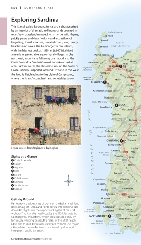
A typical scene of clothes hanging out to dry in Alghero Usellus i a Ussassai Bari Sardo
S
Arborea Nurallaó
A
Capo della Ales Monte S. Vittoria
R
Sights at a Glance D Frasca Terralba Uras Turri Nurri 1212m R
1 Costa Smeralda E Perdasdefogu A
2 Sassari Pardu Atzei C Sardara Mandas Melisenda M
a Villamar
3 Alghero N m
G
4 Bosa Guspini p i San Basilio
5 Nuoro A d Serrenti San Nicolò Gerrei
6 Cala Gonone Capo Pecora Villacidro a n o Samassi
7 Oristano Buggerru Monte Linas Sant'Andrea Frius Villaputzu
1236m
8 Sant’Antioco Muravera
9 Cagliari Masua Vallermosa Mannu San Sperate S a r r a b u s San Priamo
Burcei
Iglesias Sinnai Capo Ferrato
Siliqua
Getting Around Gonnesa Quartu Sant'Elena
Ferries from a wide range of ports on the Italian mainland Portoscuso Narcao CAGLIARI
dock at Cagliari, Olbia and Porto Torres. International and Carbonia Maddalena Geremeas
Isola di
domestic flights use the airports at Cagliari, Olbia and San Pietro Calasetta Monte Caravius Spiaggia Golfo Villasimius
1116m
Alghero. The island is neatly cut by the S131. It skirts the Santadi di Cagliari
Gennargentu mountains, which are accessible only by SANT'ANTIOCO Porto Botte Sarroch
tortuously winding passes. Branches of the S131 reach Isola di Golfo Pula
di
Olbia and Nuoro. Express bus services connect the major Sant'Antioco Palmas Capo di Pula
cities, while the smaller towns are linked by slow and Teulada
infrequent public transport.
Capo Teulada
For additional map symbols see back flap
550-551_EW_Italy.indd 550 4/5/17 9:31 AM