
Page 125 - (DK Eyewitness) Travel Guide - Washington, DC
P. 125
W ASHINGT ON , DC AREA B Y AREA 123
GEORGETOWN
Georgetown developed well before Ohio Canal were built in 1828, and the streets
Washington, DC. Native Americans had a were lined with town houses. The birth of the
settlement here, and in 1703 a land grant railroad undercut Georgetown’s econ omy,
was given to Ninian Beall, who named which by the mid-1800s was in decline. But
the area the Rock of Dumbarton. By the mid- by the 1950s the cobblestone streets and
18th century immigrants from Scotland had charming houses were attracting wealthy
swelled the population, and in 1751 the town young couples, and restaurants and shops
was renamed George Town. It grew rapidly sprang up on Wisconsin Avenue and M Street.
into a wealthy tobacco and flour port and Today Georgetown retains its quiet distinction
finally, in 1789, the city of Georgetown was from the rest of the city, and is a pleasant area
formed. The harbor and the Chesapeake and in which to stroll for a few hours (see pp150–51).
Sights at a Glance
Historic Buildings Restaurants see pp187–8
5 Old Stone House 1 1789 17 Kafe Leopold
7 Washington Post Office 2 Baked and Wired 18 Martin’s Tavern
9 Georgetown University 3 Bodega 19 Le Pain Quotidien
0 Tudor Place 4 Booeymonger 20 Paolo’s
e Dumbarton Oaks 5 Café Bonaparte 21 Patisserie Poupon
Streets, Canals, and Harbors 6 Café Divan 22 Paul
1 Washington Harbour 7 Café Milano 23 Pizzeria Paradiso
8 El Centro D.F.
24 Sea Catch
2 Wisconsin Avenue 9 La Chaumiere 25 Sequoia
4 The Chesapeake and Ohio Canal 10 Chez Billy Sud 26 ShopHouse Southeast
6 M Street 11 Clyde’s Asian Kitchen
8 N Street
12 Das Ethiopian Cuisine 27 Simply Banh Mi
Churches and Cemeteries 13 Farmers Fishers Bakers 28 Sweetgreen
3 Grace Church 14 Filomena 29 The Tombs
q Mt. Zion Church 15 Fiola Mare 30 Tony and Joe’s Seafood Café
w Oak Hill Cemetery 16 Georgetown Cupcake 31 Unum
See also Street Finder
WHITEHAVEN ST NW
maps 1–2 DUMBARTON
35TH STREET NW S ST NW LOVERS LANE W A L KWAY N W MASSACHUSETTS AVENUE
OAKS PARK
34TH ST NW
MONTROSE
PARK
OAK HILL
ROCK CREEK PARKWAY
RESERVOIR ROAD NW WINFIELD LN R STREET NW 32ND STREET NW 31ST STREET NW CEMETERY NW NW SHERIDAN
R STREET NW
Rock Creek
NW
CIRCLE
NW
4 4 T H S T R E E T N W GEORGETOWN Q O P NW ST STREET ST 29TH ST 28TH NW NW
NW
W I S C O N S I N
VOLTA
PARK
ST
VOLTA PLACE NW
NW
STREET
P STREET NW
30TH
35TH ST NW
Q STREET NW AV E N W
NW
STREET
N
NW
N
STREET
ST
1 •29 36TH ST NW O ST NW 33RD STREET NW POTOMAC ST NW DUMBARTON STREET NW ROCK CREEK PARKWAY
PROSPECT ST 9 •19 •26
NW
M STREET NW
CANAL ROAD NW
FRANCIS SCOTT KEY MEMORIAL BRIDGE Chesapeake and Ohio Canal 31ST
11 22 •14
WHITEHURST FREEWAY NW
880 yards (800 m)
0 meters 500 P o t o m a c R i v e r Foggy Bottom GWU
0 yards 500
13 •25 •30
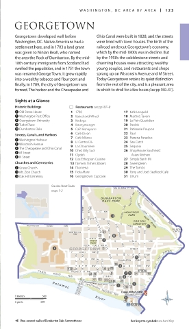
Vine-covered walls of Dumbarton Oaks Summerhouse For keys to symbols see back flap
122-123_EW_Washington.indd 123 04/04/17 2:29 pm