
Page 182 - (DK Eyewitness) Top 10 Travel Guide - Brussels Bruges Ghent & Antwerp
P. 182
180 STREE T FINDER
BRUSSELS STREET FINDER
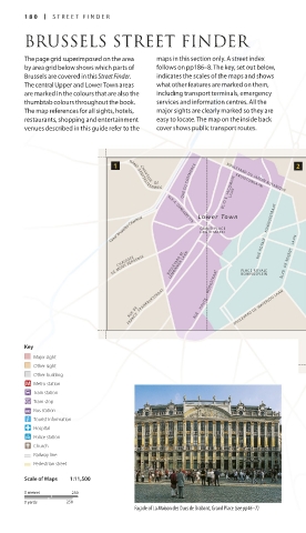
The page grid superimposed on the area maps in this section only. A street index
by area grid below shows which parts of follows on pp186–8. The key, set out below,
Brussels are covered in this Street Finder. indicates the scales of the maps and shows
The central Upper and Lower Town areas what other features are marked on them,
are marked in the colours that are also the including transport terminals, emergency
thumbtab colours throughout the book. services and information centres. All the
The map references for all sights, hotels, major sights are clearly marked so they are
restaurants, shopping and entertainment easy to locate. The map on the inside back
venues described in this guide refer to the cover shows public transport routes.
QUE DU COMMERCE KRUIDTUINLAAN
BLVD E. JACQMAIN
CHAUSS E E DE
GAND GENTSEST E E NWEG
LAAN
BOULEVARD DU JARDIN BOTANIQUE
LEUVENS ESTEENWEG
Canal Bruxelles-Charlerol RUE A. DANSAERT STR. Lower Town RUE ROYALE KONINGSSTRAAT CHAUSSEE DE LOUVAIN
GRAND PLACE
GROTE MARKT
AVE DE CORTENBERG
Upper Town
LEMONNIER LAAN
DE MONS BERGENSE BOULEVARD M. PLACE ROYALE BLVD DE REGENT LAAN RUE DE LA LOI WETSTR. R. SCHUMAN KORTENBERGLAAN BVD BRAND WHITLOCK LAAN
CHAUSSEE
ROND PONT
KONINGSPLEIN
PLEIN
RUE BELLIARD STRAAT
FRANCE FRANKRIJKSTRAAT RUE HAU TE HOOGSTRAAT BOULEVARD DE WATERLOO LAAN AVE DE TERVUREN LAAN
RUE DE
Key RUE DU TRONE TROONSTRAAT
Major sight
Other sight
Other building
Metro station
Train station
Tram stop
Bus station
Tourist information
Hospital
Police station
Church
Railway line
Pedestrian street
Scale of Maps 1:11,500
0 metres 250
0 yards 250
Façade of La Maison des Ducs de Brabant, Grand Place (see pp46–7)
180-181_EW_Brussels.indd 180 10/01/17 10:55 am