
Page 84 - All About History - Issue 34-16
P. 84
Through History
NAVIGATION
Today, finding your way is as simple as taking out your phone. But before the
dawn of GPS, people had to find their way using just the Sun and stars. See how
navigation has changed over the years
MAP 7000 BCE
When maps came into existence, o
whether they were ‘invented’ at all
hard to deduce, as there isn’t a clea
definition of a map. Mapmaking,
or cartography, is considered to
be as much an exact science as
The stars have provided valuable an art. Cartography as a way to
information about direction and communicate spatial information
location since the start of man is thought to date back to the
CELESTIAL NAVIGATION 7th millennium BCE, with a The compass was first used
in the Han Dynasty, but was
UNKNOWN wall painting of the ancient city initially used for fortune-
telling boards
Çatalhöyük. However, it is thought that the Greeks
People have been using the sky to navigate revolutionised the creation of maps, as shown by COMPASS 206 220 BCE
since time immemorial, using basic truths such artefacts found from the Byzantine era, notably the
as the Sun rising in the east and setting in the works of scholar Claudius Ptolemy, who was one of The compass works by using a suspended
west, but celestial navigation takes a different the first to attempt conic projections. magnetic needle that is attracted to the Earth’s
approach. It requires a navigator to deduce North Pole. Earth in itself works like a magnet,
their position by choosing a celestial body (eg and the south pole of a magnet is attracted to the
the Sun) and using angular measurements north pole of another. Use of this basic mechanism
between it and the visible horizon. This occurs at several points in history, in various parts
measured angle, or ‘sight’, is related to the of the world. The earliest evidence of a compass
celestial body’s geographic position and the was in 206 BCE, in the Chinese Han Dynasty,
navigator’s position. The measurement can although it wasn’t used by European sailors until
then be used to plot a line of position Claudius the 13th century. Ships became equipped with a
on a chart. Celestial navigation is Ptolemy far more precise mounted compass in the 19th
GRECO-EGYPTIAN 100-170
still practised, though more out of Ptolemy was a mathematician, century, and at the turn of the 20th century, the
interest rather than necessity. astronomer, geographer and Maps have political significance gyroscopic compass was invented.
cartographer, among other things. – it wasn’t uncommon to
Little is known about him, but various exaggerate the size or reach of
examples of his works survived, land for bragging rights
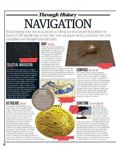
ASTROLABE 200 BCE including Geographia, a collection SUNSTONE 8TH 11TH CENTURY
The astrolabe, first and foremost, was a of coordinates of the Roman The sunstone The Vikings were
Empire that revolutionised
was thought to
beautiful piece of craftsmanship, usually map making. be Iceland spar, a determined explorers
made out of bronze or similar valuable transparent calcite and settlers, and used a
materials. It was a device used for making that refracted gem called a sunstone to
sunlight
calculations and astronomical measurements, determine their position
and in that respect worked much like an on the water. The gem
analog computer, such as a slide rule or was said to create a double
nomogram. It was commonly used in the refraction of sunlight, even
Middle Ages and had many purposes, when it was overcast, which helped determine the
among which were astronomy and position of the Sun if the holder rotated the stone
astrology. For the purpose of navigation, until the shadows created by the double refraction
however, it was used to calculate the altitude appeared equal. Whether such a stone really existed
and position of celestial bodies. It could then has been contested for many years, and while a
be used to deduce the local time, or, using stone bearing its resemblance was found in an
a process called triangulation, the navigator’s Elizabethan shipwreck in 2013, the truth behind
position. Triangulation uses angles, geometry and its existence and functionality remains a mystery.
mathematical calculations to deduce position based on The production of an astrolabe requires However, it appears in Viking folklore often enough
great precision and craftsmanship, and
celestial bodies, bearing a resemblance to celestial navigation. is considered an art to assume Norsemen had faith in its guidance.
84