
Page 31 - Interactive report Ar Site Practice
P. 31
Levelling
Leveling is a method or element of land surveying which deals with determining
points on land surface above sea level. The points of known height are called
benchmarks and they are determined from an assumed zero height point at sea
level called a datum. It employs leveling instruments such as theodolite and the
Abney level. It help pipe transport engineers to ensure appropriate slope of the
land that will allow smooth movement of the liquid in the transit e.g water and
liquid. It help contractors to lay a level ground on which they can elect the building.
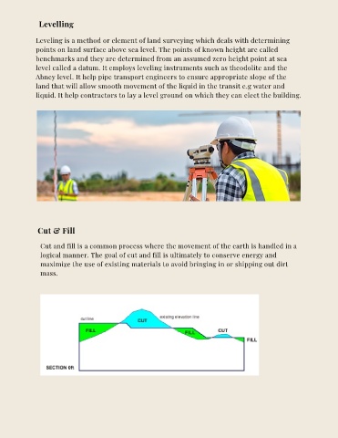
Cut & Fill
Cut and fill is a common process where the movement of the earth is handled in a
logical manner. The goal of cut and fill is ultimately to conserve energy and
maximize the use of existing materials to avoid bringing in or shipping out dirt
mass.