
Page 275 - (DK Eyewitness) Travel Guide - Pacific Northwest
P. 275
BRITISH C OL UMBIA 273
this distinction with the Mile moose, deer, elk, and black bears
Zero post at 10th Street and abound. During the 1942 con-
102nd Avenue. Located at the struction of the Alaska Highway,
corner of Highway 97 and the the town’s population increased
Alaska Highway, the red-and- dramatically, from 800 to 6,000.
white 1931 Northern Alberta When completed, the highway
Railway Station is turned Fort St. John into a busy
now a museum and supply center catering to visitors
information center. to the area and supporting the
The site includes the agriculture industry in the
Mile Zero stone cairn surrounding countryside.
marking the official The town boomed in the
start of the Alaska 1950s, when oil was found
Highway. Next to the here in what proved to be
railway station is a 1948 the largest oil field in BC.
grain elevator annex The city’s pride in its The steaming waters of the Liard River
that is now an art gallery. industrial heritage is Hot Springs, near Fort Nelson
The conversion of elevator reflected in its museum,
to gallery involved the which has a 140-ft- (43-m-) Fur trading was the main activity
removal of 10 tons of grain high oil derrick at its entrance until the energy boom; even
dust. Shows include the and exhibits telling today trappers continue to
work of local artists as the story of the local hunt beaver, wolf, and lynx, for
well as major traveling oil industry. Other both their fur and their meat.
collections. On Saturday The Mile Zero post activities include This town at Mile 300 of the
mornings from May at Dawson Creek cross-country Alaska Highway has an air
to October, a farmers’ skiing at Beatton and bus service, a hospital, and
market held across from the Provincial Park in the winter. good visitor facilities such as
stone cairn sells local produce Another popular seasonal motels, restaurants, and gas
and crafts. activity is watching the northern stations. Local people are
At Walter Wright Pioneer lights, very visible here. known for their friendliness,
Village, restored buildings and and during the busy summer
farm machinery recreate the months they run a program of
agricultural community of f Fort Nelson free talks for visitors, describing
Dawson Creek before the Road map 2 B2. * 3,900. life in the North.
highway was built. n 5319 50th Ave S, (250) 774-2956. The small Fort Nelson
∑ tourismnorthernrockies.ca Heritage Museum displays
P Walter Wright Pioneer Village photographs and artifacts that
1901 Alaska Hwy. Tel (250) 782- Despite the growth of the oil, tell the story of the building of
7144. Open mid-May–Aug: 9am– gas, and lumber industries the Alaska Highway, and features
8pm daily. Closed Sep–mid-May. in the 1960s and 1970s, Fort a frontier-town general store
& donation. 7 ∑ mile0park.ca Nelson retains the atmosphere and blacksmith’s forge. The
of a northern frontier town. trapper’s log cabin behind the
Before the building of the museum is also worth visiting.
d Fort St. John Alaska Highway in the 1940s, The region has over a dozen
Fort Nelson was an important parks, including Liard River
Road map 2 B2. * 19,000.
n 9324 96 St, (250) 785-3033. stop en route to Yukon and Provincial Park; its hot springs
∑ fortstjohn.ca Alaska, and until the 1950s are open year-round. The area
it was without telephones, is a world-class cross-country
The city of Fort St. John is running water, or electricity. skiing destination.
located at Mile 47 of the Alaska
Highway, among the rolling hills
of the Peace River Valley. Fort
St. John, originally one of six
forts built in the area between
1794 and 1925, is the oldest
non-Native settlement in British
Columbia. At nearby Charlie
Lake Cave, 10,000-year-old
artifacts of the Paleo Indians
have been found, making it
the site of the earliest-known
human activity in the province.
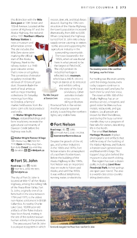
The area around Fort St. John
is a unique ecosystem in which Farmland alongside the Peace River near Fort St. John
US_PNW_272-273_Catalog4.indd 273 04/07/16 12:35 pm