
Page 68 - (DK Eyewitness) Travel Guide - Sydney
P. 68
66 SY DNEY AREA B Y AREA
Street-by-Street: The Rocks
Named for the rugged cliffs that were once its dominant
feature, this area has played a vital role in Sydney’s
development. In 1788, the First Fleeters under Governor
Phillip’s command erected makeshift buildings here, with
the convicts’ hard labour used to establish more permanent
structures in the form of rough-hewn streets. The Argyle
Cut, a road carved through solid rock using just hammer
and chisel, took 18 years to build, beginning in 1843.
By 1900, The Rocks was overrun with disease; the street
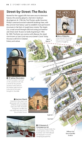
now known as Suez Canal was once Sewer’s Canal. Today, q Hero of Waterloo
the area is still rich in Colonial Hero of Lying beneath this historic
pub is a tunnel originally
history and colour. Waterloo used for smuggling.
L OWER FOR T STREE T
TRINITY AVENUE
A R G Y L E S T R E E T
W AT S O N R O A D
U P P E R F O R T S T R E E T
B R A D F I E L D H I G H W A Y
C U M B E R L A N D S T R E E T
G L O U C E S T E R
0 . Sydney Observatory
The first European struc ture
on this prominent site was
a windmill. The present P L A Y F A I R S T R E E T
museum holds some of
the earliest astro nomical
instruments that were
H A R R I N G T O N S T R E E T A R G Y L E S T R E E T
brought to Australia.
9 Garrison Church
Columns in this church are
decorated with the insignia
of British troops stationed
here until 1870. Australia’s G E O R G E S T R E E T
first prime minister was
educated next door, at Fort
Street Public School.
Argyle Cut
Suez Canal
o . Museum of
Contemporary Art
The Classical façade belies the
contemporary nature of the Walkway along
Australian and inter national Circular Quay West
art displayed in an ever- foreshore
changing programme.
066-067_EW_Sydney.indd 66 29/05/17 12:19 pm