
Page 281 - NS-2 Textbook
P. 281
276 NAUTICAL SCIENCES
for the year ahead; these are based on average weather
reported for years past.
Local weather is predicted up to a month or so in ad-
vance. The accuracy of these predictions is dependent
upon timely readings taken at many reporting stations-
on land and by weather ships, balloons, and weather
satellites. While forecasting is becoming much more ac-
curate, it still is not an exact science, due to the wide va-
riety of local atmospheric uncertainties.
In the Navy elements of the Naval Meteorological
and Oceanography Command prepare several types of
forecasts, each for a specific purpose and containing spe-
cific information.
Area forecasts are prepared by major units afloat and
ashore. The area covered is the If operating area" of the
major units. Area forecasts will include a synopsis of
weather conditions in the forecast area. They will report
all pressure systems and their associated ·weather, in-
cluding the system's position, intensity, and direction of
movement. Intensity will include wind direction and ve-
locity, visibility, and weather types. Position will always
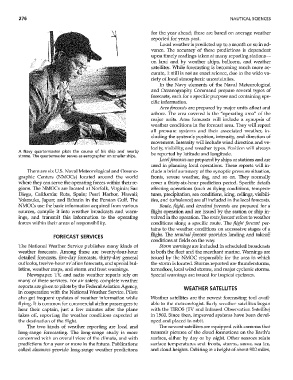
A Navy quartermaster plots the course of his ship and nearby
storms. The quartermaster serves as aerographer on smaller ships. be reported by latitude and longitude.
Local forecasts are prepared by ships or stations and are
used in planning local operations. These reports will in-
There are six U.s. Naval Meteorological and Oceano- clude a brief summary of the synoptic pressure situation,
graphic Centers (NMOCs) located around the world fronts, severe "veather, fog, and so on, They normally
where they can serve the operating forces within their re- cover a thirty-six-hour prediction period. Specific details
gions. The NMOCs are located at Norfolk, Virginia; San affecting operations (such as flying conditions, tempera-
Diego, California; Rota~ Spain; Pearl Harbor, Hawaii; tw'es, precipitation, sea conditions, icing, ceilings, visibili-
Yokosuka, Japan; and Bahrain in the Persian Gulf. The ties, and turbulence) are all included in the local forecasts.
NMOCs use the basic information acquired from various ROllte, flight, and terminal forecasts are prepared for a
sources, compile it into weather broadcasts and \varn- flight operation and are issued by the station 01' ship in-
ings, and transmit this information to the operating volved in the operation. The rOllte forecast refers to weather
forces within their areas of responsibility. conditions along a specific route. The flight forecast per-
tains to the weather conditions on successive stages of a
flight. TIle termillal forecast provides landing and takeoff
FORECAST SERVICES
conditions at fields on the way.
The National Weather Service publishes many kinds of Storm wal'1lings are included in scheduled broadcasts
weather forecasts. Among these are twenty-four-hour to both the fleet and the merchant marine. Warnings are
detailed forecasts, five-day forecasts, thirty-day general issued by the NMOC responsible for the area in which
outlooks, twelve-hour aviation forecasts, and special bul- the stornl is located. Storms reported are thunderstorms,
letins, weather maps, and storm and frost warnings. tornadoes, local wind storms, and major cyclonic storms,
Newspaper, TV, and radio weather reports rely on Special warnings are issued for tropical cyclones.
many of these services. For air safety, complete weather
reports are given to pilots by the Federal Aviation Agency,
WEATHER SATELLITES
in cooperation with the National Weather Service. Pilots
also get frequent updates of weather information while Weather satellites are the newest forecasting tool avail-
flying. It is common for commercial airline passengers to able to the meteorologist. Early weather satellites began
hear their captain, just a few minutes after the plane with the TIROS (TV and Infrared Observation Satellite)
takes off, reporting the weather conditions expected at in 1960. Since then, improved systems have been devel-
the destination of the flight. oped and placed in orbit.
The two kinds of weather reporting are local and The newest satellites are equipped with cameras that
long-range forecasting. The long-range study is more transmit pictures of the cloud formations on the Earth's
concerned with an overall view of the climate, and with surface, either by day or by night. Other sensors relate
predictions for a year or more in the future. Publications surface temperatures and fronts, storms, snmv, sea ice,
called almallacs provide long-range weather predictions and cloud heights. Orbiting at a height of about 900 miles,