
Page 195 - 9 teachers social book 9 @ 2077 ctp_Neat
P. 195
because of its greater distance from the sea. It has mainly alluvial deposited and
irrigated by the large rivers like the Koshi, the Karnali and the Narayani and their
tributaries and underground sources of water. This region has very high agricultural
production. So, it is popularly known as the granary of the country. It has dense
sub-tropical evergreen forest. It is densely populated region with high availability of
infrastructure like transportation, communication, etc. Irrigation facilities and many
industries are established in the Terai region.
The Hilly Region
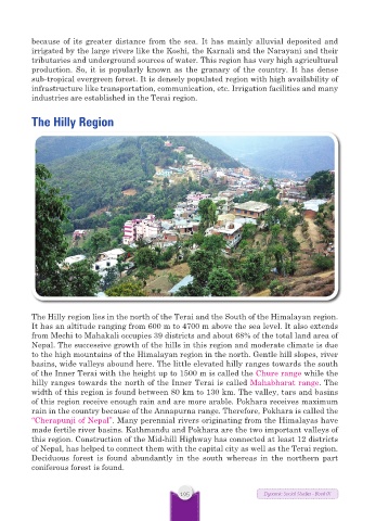
The Hilly region lies in the north of the Terai and the South of the Himalayan region.
It has an altitude ranging from 600 m to 4700 m above the sea level. It also extends
from Mechi to Mahakali occupies 39 districts and about 68% of the total land area of
Nepal. The successive growth of the hills in this region and moderate climate is due
to the high mountains of the Himalayan region in the north. Gentle hill slopes, river
basins, wide valleys abound here. The little elevated hilly ranges towards the south
of the Inner Terai with the height up to 1500 m is called the Chure range while the
hilly ranges towards the north of the Inner Terai is called Mahabharat range. The
width of this region is found between 80 km to 130 km. The valley, tars and basins
of this region receive enough rain and are more arable. Pokhara receives maximum
rain in the country because of the Annapurna range. Therefore, Pokhara is called the
“Cherapunji of Nepal”. Many perennial rivers originating from the Himalayas have
made fertile river basins. Kathmandu and Pokhara are the two important valleys of
this region. Construction of the Mid-hill Highway has connected at least 12 districts
of Nepal, has helped to connect them with the capital city as well as the Terai region.
Deciduous forest is found abundantly in the south whereas in the northern part
coniferous forest is found.
195 Dynamic Social Studies - Book IX