
Page 28 - Social Studies 7
P. 28
The districts of this province are :
1. Dolakha 2. Ramechhap 3. Sindhuli
4. Kavrepalanchok 5. Sindhupalchok 6. Rasuwa
7. Nuwakot 8. Dhading 9. Chitwan
10. Makawanpur 11. Bhaktapur 12. Lalitpur
13. Kathmandu
Gandaki Pradesh
With an area of 21,504 Sq. Km.,
this province lies between China in
the north and Province No. 5 in the
south. Its total population is 24,13,907
(census 2011 AD). The literacy rate is
74.81%. Mt. Annapurna (8,091 m), Mt.
Dhaulagiri (8,176 m), Mt. Manaslu
(8,163 m), Mt. Himalchuli (7,893 m)
and Mt. Machhapuchhre (6,993 m) are
important peaks of this region.
Fewa, Rupa, Begnas and Tilicho are
the major lakes and Kaligandaki,
Marshyangdi, Daraudi, Seti, etc. are
the major rivers of this place. Muktinath and Manakamana are very famous
religious destinations of this region. Best known for tourism are Annapurna
conservation Area, Ghale Gaun, Upper Mustang, Kagbeni, Dhorpatan Hunting
Reserve and Pokhara are very famous tourist destinations of Nepal where we can
get the true picturesque of natural Nepal.
The Magars, the Gurungs, and the Thakalis, including the Tharus are the major
indigenous groups of this area. Besides tourism, agriculture, natural resources
and remittance are other sources of income for this region.
The total number of districts is 11 that include 1 metropolitan city, 26 municipalities
and 58 gaupalikas.
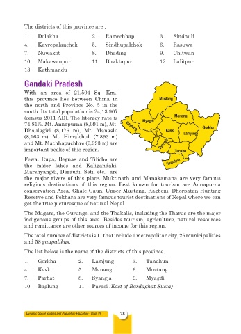
The list below is the name of the districts of this province.
1. Gorkha 2. Lamjung 3. Tanahun
4. Kaski 5. Manang 6. Mustang
7. Parbat 8. Syangja 9. Myagdi
10. Baglung 11. Parasi (East of Bardaghat Susta)
Dynamic Social Studies and Population Education - Book VII 28