
Page 134 - (DK Eyewitness) Travel Guide - Brittany
P. 134
132 BRIT T AN Y REGION B Y REGION
q Côte des Abers
Three long, fjord-like indentations scar
the coastline between Brignogan and
Le Conquet. These are known as abers –
a Celtic word meaning “estuary”. They were
formed as glaciers began to melt at the end
of the Ice Age, 10,000 years ago. As the sea
level rose, sea water flowed up the valleys
far inland, where it met the fresh water of
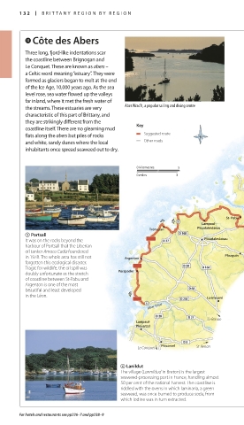
the streams. These estuaries are very Aber Wrac’h, a popular sailing and diving centre
characteristic of this part of Brittany, and
they are strikingly different from the Key
coastline itself. There are no gleaming mud
flats along the abers but piles of rocks Suggested route
and white, sandy dunes where the local Other roads
inhabitants once spread seaweed out to dry.
J
0 kilometres 5
0 miles 3 Aber Wrac’h
Landéda
J J Lampaul- St- Pabu Aber Benoît
Trémazan Ploudalmézeau
5 Portsall
It was on the rocks beyond the Ploudalmézeau
harbour of Portsall that the Liberian
oil tanker Amoco Cadiz foundered
in 1978. The whole area has still not Argenton Plouguin
forgotten this ecological disaster.
Tragic for wildlife, the oil spill was
doubly unfortunate as the stretch Porspoder
of coastline between St-Pabu and
Argenton is one of the most
beautiful and least developed
in the Léon. J
Lanrivoaré
Aber Ildut
St-Renan
Lampaul-
Plouarzel
Le Conquet Plouarzel St-Renan
6 Lanildut
The village (Lannildud in Breton) is the largest
seaweed-processing port in France, handling almost
50 per cent of the national harvest. The coastline is
riddled with the ovens in which laminaria, a green
seaweed, was once burned to produce soda, from
which iodine was in turn extracted.
For hotels and restaurants see pp226–7 and pp238–9
132-133_EW_Brittany.indd 132 11/3/16 12:42 PM