
Page 79 - (DK Eyewitness) Travel Guide - Brittany
P. 79
ILLE-E T-VILAINE 77
atmospheric conditions. It is,
apparently, possible to predict
the weather accordingly, and
every bit as accurately as the
official forecast.
Oak stakes, known as
bouchots, can be seen all along
the bay. Driven into the sea
bed, they are used for mussel-
breeding, a practice that goes
back as far as the 13th century.
A quarter of all mussels farmed
in France are raised in this bay,
where the yield reaches 10,000
tonnes per year.
Windmills and low thatched
houses line the coast as far
as Cancale. At Le Vivier-sur-
Mer, the Maison de la Baie
houses a exhibition on mussel-
farming and on the area’s
plants and animals. Visits to
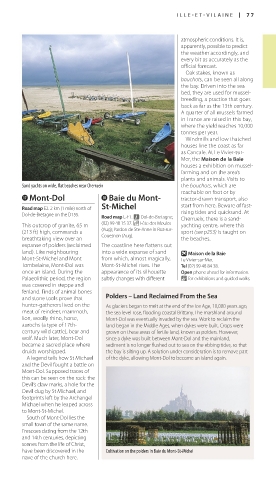
Sand yachts on wide, flat beaches near Cherrueix the bouchots, which are
reachable on foot or by
u Mont-Dol i Baie du Mont- tractor-drawn transport, also
Road map E2. 2 km (1 mile) north of St-Michel start from here. Beware of fast-
Dol-de-Bretagne on the D155. Road map E-F1. n Dol-de-Bretagne; rising tides and quick sand. At
Cherrueix, there is a sand-
This outcrop of granite, 65 m (02) 99 48 15 37. _ Fête des Moules yachting centre, where this
(213 ft) high, commands a (Aug); Pardon de Ste-Anne in Roz-sur- sport (see p253) is taught on
Couesnon (Aug).
breathtaking view over an the beaches.
expanse of polders (reclaimed The coastline here flattens out
land). Like neighbouring into a wide expanse of sand O Maison de la Baie
Mont-St-Michel and Mont from which, almost magically, Le Vivier-sur-Mer.
Tombelaine, Mont-Dol was Mont-St-Michel rises. The Tel (02) 99 48 84 38.
once an island. During the appearance of its silhouette Open phone ahead for information.
Palaeolithic period, the region subtly changes with different & for exhibitions and guided walks.
was covered in steppe and
fenland. Finds of animal bones
and stone tools prove that Polders – Land Reclaimed From the Sea
hunter-gatherers lived on the As glaciers began to melt at the end of the Ice Age, 10,000 years ago,
meat of reindeer, mammoth, the sea level rose, flooding coastal Brittany. The marshland around
lion, woolly rhino, horse, Mont-Dol was eventually invaded by the sea. Work to reclaim the
aurochs (a type of 17th- land began in the Middle Ages, when dykes were built. Crops were
century wild cattle), bear and grown on these areas of fertile land, known as polders. However,
wolf. Much later, Mont-Dol since a dyke was built between Mont-Dol and the mainland,
became a sacred place where sediment is no longer flushed out to sea on the ebbing tides, so that
druids worshipped. the bay is silting up. A solution under consideration is to remove part
A legend tells how St Michael of the dyke, allowing Mont-Dol to become an island again.
and the Devil fought a battle on
Mont-Dol. Supposed traces of
this can be seen on the rock: the
Devil’s claw marks, a hole for the
Devil dug by St Michael, and
footprints left by the Archangel
Michael when he leaped across
to Mont-St-Michel.
South of Mont-Dol lies the
small town of the same name.
Frescoes dating from the 12th
and 14th centuries, depicting
scenes from the life of Christ,
have been discovered in the Cultivation on the polders in Baie du Mont-St-Michel
nave of the church here.
076-077_EW_Brittany.indd 77 11/3/16 12:42 PM