
Page 196 - (DK Eyewitness) Travel Guide 2017 - Alaska
P. 196
194 ALASK A AREA B Y AREA
centuries, the modern town
came up as a housing site for
workers during the construc tion
of the Alaska and Glenn
Highways in the 1940s. Tok’s
economy was later enhanced
by a fuel line from Haines
to Fairbanks in 1954 and the
opening of a Loran station,
built in 1976 as an aid to long-
range navigation.
Tok is now a service center
with a range of accommoda-
tion, RV parks, eateries, and
gas stations. It also has three
information centers: the Tok
Main Street Visitors Center, the
Alaska Public Lands Information
Center next door, and a Tetlin
National Wildlife Refuge ranger
station about 5 miles (8 km)
southwest of town. The
Fortymile Country (see p196), a
gold mining region with historic
and active claims, stretches
north over undulat ing
landscape along the Taylor
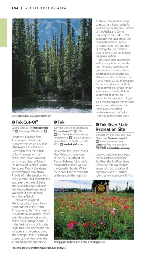
Swans paddling in a lake, just off Tok Cut-Off Highway to the Yukon River.
0 Tok Cut-Off q Tok
w Tok River State
Gakona Junct. to Tok. Transport map 206 miles (331 km) SE of Fairbanks. Recreation Site
E3. @ Anchorage–Whitehorse. Transport map F3. * 1,300.
@ from Fairbanks and Anchorage 5 miles (8 km) E of Tok at Mile 1309,
For drivers heading from to Whitehorse. n Tok Main St Visitors Alaska Hwy. Transport map F3.
Anchorage to the Alaska Center, Mile 1314, Alaska Hwy; 883- @ Anchorage–Whitehorse.
Highway, the scenic 125-mile 5775. ∑ tokalaskainfo.com Open mid-May–mid-Sep: daily.
(200-km) Tok Cut-Off links & ∑ alaskastateparks.org
Glennallen with the village Situated in the upper Tanana
of Tok. The southern half River Valley, at the junction Located beside a sandy beach
of the route looks eastward of the Tok Cut-Off and the on the eastern bank of the
on to broad vistas of Mount Alaska Highway, Tok is the first Tok River, the Tok River State
Drum, Mount Sanford, Mount major Alaskan town west of Recreation Site is a popular
Jarvis, and Mount Blackburn the Canadian border. While venue with both locals and
in the Wrangell Mountains. there have been Athabaskan highway travelers. Families
At Mile 60 is the junction with settlements in the region for spend sunny afternoons fish ing
the Nabesna Road, which leads
east, past the town of Slana
and several hiking trailheads
into the northern reaches of
Wrangell-St. Elias National
Park (see pp192–3).
The Native village of
Mentasta Lake, the northern-
most outpost of the Ahtna
Athabaskans, lies in the heart of
the Mentasta Mountains, which
form the easternmost extent
of the Alaska Range. About 16
miles (26 km) short of Tok, the
Eagle Trail State Recreation Site
includes a large campground
and a steep 2-mile (3-km) trail
to spec tacular views over the
sur rounding hills and valleys. Arctic poppies produce a burst of color in the village of Tok
For hotels and restaurants in this area see p245 and p255
194-195_EW_Alaska.indd 194 02/05/17 2:31 pm