
Page 102 - (DK Eyewitness) Top 10 Travel Guide - Israel & Petra
P. 102
100 ❯❯ Israel and Petra Area by Area
The Best of the Rest
Metzukei Dragot
5
Viewpoint
MAP G5 • 11 miles (17 km) S of
Einot Tzukim
A steep road leads to the top of
sheer cliffs, with breathtaking views,
especially in the afternoon, of the
Dead Sea and mountains in Jordan.
Ein Bokek
6
Set on the shore of the Dead
Sea’s southern basin, this strip is the
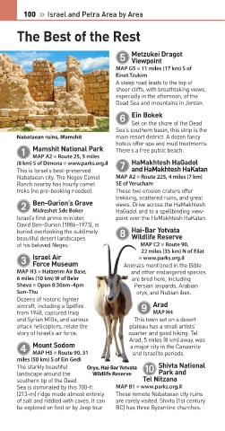
Nabataean ruins, Mamshit main resort district. A dozen fancy
hotels offer spa and mud treatments.
Mamshit National Park
1 There’s a free public beach.
MAP A2 • Route 25, 5 miles
HaMakhtesh HaGadol
(8 km) S of Dimona • www.parks.org.il 7
This is Israel’s best-preserved and HaMakhtesh HaKatan
Nabataean city. The Negev Camel MAP A2 • Route 225, 4 miles (7 km)
Ranch nearby has hourly camel SE of Yerucham
treks (no pre-booking needed). These two erosion craters offer
trekking, scattered ruins, and great
Ben-Gurion’s Grave
2 views. Drive across the HaMakhtesh
HaGadol and to a spellbinding view-
Midreshet Sde Boker
Israel’s first prime minister, point over the HaMakhtesh HaKatan.
David Ben-Gurion (1886–1973), is
Hai-Bar Yotvata
buried overlooking the sublimely 8
beautiful desert landscapes Wildlife Reserve
of his beloved Negev. MAP C2 • Route 90,
22 miles (35 km) N of Eilat
Israel Air
3 Animals mentioned in the Bible
• www.parks.org.il
Force Museum
MAP H3 • Hatzerim Air Base, and other endangered species
6 miles (10 km) W of Be’er are bred here, including
Sheva • Open 8:30am–4pm Persian leopards, Arabian
Sun–Thu oryx, and Nubian ibex.
Dozens of historic fighter
Arad
aircraft, including a Spitfire 9
from 1948, captured Iraqi MAP H4
and Syrian MiGs, and various This town set on a desert
attack helicopters, relate the plateau has a small artists’
story of Israel’s air force. quarter and good hiking. Tel
Arad, 5 miles (8 km) away, was
Mount Sodom
4 a major city in the Canaanite
and Israelite periods.
MAP H5 • Route 90, 31
miles (50 km) S of Ein Gedi
Shivta National
The starkly beautiful Oryx, Hai-Bar Yotvata 0
land scape around the Wildlife Reserve Park and
southern tip of the Dead Tel Nitzana
Sea is dominated by this 700-ft MAP B1 • www.parks.org.il
(213-m) ridge made almost entirely These remote Nabataean city ruins
of salt and riddled with caves. It can are rarely visited. Shivta (1st century
be explored on foot or by Jeep tour. BC) has three Byzantine churches.
Eyewitness Travel – Top 10 series LAYERS PRINTED:
Two-column, 8.5pt grid “UK” LAYER
(SourceReport v.1.9)
100-101_Top_10_Israel.indd 100 19/06/2017 12:58
Date 24th June 2015
Size 100mm x 191mm