
Page 192 - (DK Eyewitness) Travel Guide - India
P. 192
190 CENTR AL INDIA
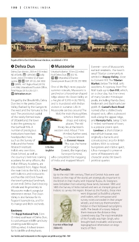
Façade of Dehra Dun’s Forest Research Institute, established in 1914
9 Dehra Dun 0 Mussoorie Everest – one of Mussoorie’s
earliest residents. The town’s
Dehra Dun district. 256 km (159 miles) Uttarkashi district. 35 km (22 miles)
NE of Delhi. * 1,699,000. ~ Jolly N of Dehra Dun. * 30,118. small Tibetan community is
Grant, 24 km (15 miles) SE of town @ n Uttarakhand Tourism settled in Happy Valley, close
centre. £ @ ISBT, (0135) 264 3838 Development Board, (0135) 255 9898. to Convent Hill. The Tibetan
n GMVN, 74/1 Rajpur Road, (0135) Market, below The Mall, sells
274 7898; Uttarakhand Tourism Office, One of the Raj’s most popular woollens. A ropeway from The
Patel Nagar, (0135) 265 3217. summer retreats, Mussoorie is Mall leads up to Gun Hill, which,
∑ dehradun.nic.in perched on a horseshoe-shaped on a clear day, has fine views
ridge above the Doon Valley at of many Greater Himalayan
Fringed by the Shivalik Hills, Dehra a height of 1,920 m (6,299 ft), peaks, including Nanda Devi,
Dun lies in the pretty Doon and is inundated with Indian Kedarnath and Badrinath (see
Valley, flanked by the Ganges to visitors in summer. Life in pp68–9). Camel’s Back Road
the west and the Yamuna to the Mussoorie centres around The named after a distinctively
east. The provisional capital Mall, the main thoroughfare, shaped rock, offers a pleasant
of the newly formed state which is lined with walk along the upper ridge,
of Uttarakhand, the town shops and eating and Kempty Falls, lying 12 km
is also the gateway to places. The old (7 miles) northwest of town,
the Garhwal Hills. A library lies at the town’s is a popular picnic spot.
number of prestigious western end. About 7 km Landour, a short distance
institutions have their (4 miles) further west, east of Kulri bazaar, was
headquarters here, is a house known originally a barracks and
such as the Survey of as Everest House. convalescence area for British
India and the Forest This was the home soldiers. With its colonial
Research Institute. Little blue of Sir George bungalows and relative quiet,
India’s very own Eton, kingfisher Everest, the legendary it has managed to preserve
Doon School, as well as Surveyor-General, some of Mussoorie’s old
the country’s foremost training who completed the mapping character and is the town’s
academy for army officers, the of India and mapped Mount prettiest quarter.
Indian Military Academy, are
also situated here. Rajpur Road,
the main link to the hills, is lined The Pundits
with bakeries and restaurants Up to the mid 19th-century, Tibet and Central Asia were vast
and has the old Clock Tower, blanks on the map of the world, yet strategically important to
the town’s principal landmark, the British in their rivalry with Imperial Russia. As foreigners
at one end. Dehra Dun’s bracing were forbidden from entering these lands, between 1865 and
climate and its proximity to 1885 the Survey of India trained and sent an intrepid group of
Mussoorie make it a popular Indians to survey the region. Known as the Pundits, these men
retirement retreat. The Doon went disguised as Buddhist pilgrims
Valley is also famous for its and traders, with compasses and
fragrant basmati rice, and for survey notes concealed in their prayer
its mango and litchi orchards. wheels, and mercury thermometers
hidden in their hollowed-out pilgrims
Environs staffs. The beads of a rosary helped
them measure the distance they
The Rajaji National Park, 5 km covered every day. The most remarkable
(3 miles) southeast of Dehra Dun, of the Pundits was Nain Singh, who
is a picturesque wildlife sanctuary brought back invaluable and accurate
covering over 800 sq km A portrait of Nain Singh topographical information on large
(309 sq miles). It is best known (1830–95) tracts of Tibet.
for its birdlife and elephants.
For hotels and restaurants in this region see p696 and pp708–709
190-191_EW_India.indd 190 26/04/17 11:44 am
Eyewitness Travel LAYERS PRINTED:
Catalogue template “UK” LAYER
(Source v2.6)
Date 12th July 2013
Size 125mm x 217mm