
Page 230 - (DK Eyewitness) Travel Guide - India
P. 230
228 CENTR AL INDIA
q Parasnath
Giridih district. 179 km (111 miles)
NE of Ranchi. £ @ Madhuban.
An important destination
for Jain pilgrims, Parasnath is
named after Parsvanatha, the
23rd Jain tirthankara (see p400),
who is believed to have attained
nirvana here. Clustered on top
of Sikayi Hill, the highest peak in
Jharkhand at 1,400 m (4,593 ft),
are 24 Jain shrines and two
temples, each one dedicated
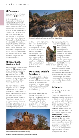
to one of the Jain tirthankaras. En route to Netarhat, through the picturesque Chhota Nagpur Plateau
The temple on the highest point
is dedicated to Parsvanatha. spotting a tiger from one of the the Palamau Tiger Reserve.
Pilgrims begin their climb from ten viewing platforms is now The sanctuary is dotted with
Madhuban, a stopover at the rare. The 190 sq-km (73 bamboo, sal (Shorea
foot of the hill, and it takes over sq-mile) park, established robusta) groves,
three hours, through forested in 1954, is bisected by towering mahua
slopes. Palanquins are available the Ranchi-Kolkata (Madhuca indica) trees
to carry those who do not want Highway, which, with its from whose pale yellow
to walk. The views from the heavy traffic, has driven flower the area’s tribal
top are magnificent. away many animals to people (Oraons and
other habitats. But there Mundas) make a potent
w Hazaribagh are plenty of wild boar, Leopard at liquor, and grassland.
nilgai and leopard, and
It is inhabited by wild
National Park its thick forests are a Palamau Sanctuary elephants, deer,
haven for birdlife. leopards, tigers and
Hazaribagh district. 135 km (84 miles)
N of Ranchi. £ Hazaribagh Rd Station, several bird species. There are
67 km (42 miles) S of Pokharia, the e Palamau Wildlife numerous watch towers and
main entry point, then bus. @ hides that have been strategically
n Tourist Office, near bus stand, Sanctuary placed around the water holes.
Hazaribagh town, located 16 km Palamau district. 170 km (106 miles) The picturesque ruins of two
(10 miles) S of Pokharia. For permission, W of Ranchi. £ Daltonganj, 24 km 16th-century forts, hot springs
contact Divisional Forest Officer, (15 miles) NW of Betla, the main entry and a few tribal villages also lie
Hazaribagh, (06546) 223 340. point. @ n Tourist Office, Betla, within the park.
(06562) 256 513. For permits contact
Set in the undulating Chhota the Deputy Director, Palamau Wildlife
Nagpur Plateau at an average Sanctuary, Daltonganj. Jeeps are r Netarhat
altitude of 615 m (2,018 ft), available at Betla. Latehar district. 160 km (99 miles)
covered with tropical deciduous W of Ranchi. @
forests, this national park is 16 km Also known as Betla National
(10 miles) from Hazaribagh. Park, the Palamau Wildlife The only hill station in Bihar and
Hazaribagh means “Thousand Sanctuary, on the northwestern Jharkhand, Netarhat is situated at
Tigers”, and this quiet town’s edge of the Chhota Nagpur an altitude of 1,158 m (3,799 ft)
environs were once famous for Plateau, is set in hilly tribal and lies deep within the forested
their tiger population. However, country, with the Koel and Chhota Nagpur hills, just off the
as a result of deforestation, most Burha rivers flowing through it. Ranchi-Hazaribagh Highway.
of the tigers are gone, and The sanctuary is also home to There are several pleasant
rambles in the hills around this
little town, and fine views of the
surrounding countryside from
Magnolia Point. The scenic
Burha Ghagh, or Burha Falls,
makes an enchanting picnic
spot. A curious building here is a
huge wooden Swiss-style chalet,
formerly the country retreat of
the British governors of Bihar,
and now a boarding school for
boys. The school authorities
Watchtower in the Hazaribagh Wildlife Sanctuary usually welcome visitors.
For hotels and restaurants in this region see p696 and p709
228-229_EW_India.indd 228 26/04/17 11:44 am
Eyewitness Travel LAYERS PRINTED:
Catalogue template “UK” LAYER
(Source v2.6)
Date 12th July 2013
Size 125mm x 217mm