
Page 208 - NS-2 Textbook
P. 208
OCEANOGRAPHY 203
miles, and a molten outer core of these metals about continents and ocean basins. With an average depth of
1,300 miles deep. Above this is about I,BOO miles of dense about 20 nllies tmder continents, Earth's crust may be as
rock called the mall tie. The uppermost layer of the man- much as 40 miles deep beneath mOlmtains. Under the
tle, several hundred miles thick, is called the astheJ1o- oceans, however, it is only 3 to 10 miles thick.
sphere. It is composed of molten rock called magma. The The lithosphere! or Earth's crust, is divided into six
rigid outer crust, the lithosphere; "rides" or "£loats" on major plates and about a dozen smaller ones. The ma-
this molten part of the mantle. The crust is Earth's sur- jor plates are the American, African, Eurasian, Indo-
face, the only part we can easily see. It consists of our Australian, Antarctic, and Pacific plates. Most of Earth's
volcanic eruptions and earthquakes occur on the bound-
aries or lIIargills of these plates.
It is not known how many tin1es our planet's plates
have separated, come together, and separated again over
the 4.5-billion-year geologic history of our planet. This
movement of landmasses is known as continental drift.
This theory was first seriously proposed about 1912.
Many studies and modern oceanographic and geologic
instruments have, in general, tended to confirm it. In the
late 1960s the theory was modified to take into account
all major geological sh'uctures of the Earth. The new the-
ory is known as plate tectollics.
Let us trace the probable geologic history of our Earth
based on the continental drift theory. After millions of
years of pressures and Shalns, SOflle 65 million years ago
Africa and South America had drifted apart. The Atlantic
and Indian Oceans had formed, and North America and
Europe were about to split, leaving Greenland to stand be-
tween them in the Northern Hemisphere. India moved
rapidly (relatively) across the Indian Ocean on its 5,500-
mile, lBO-million-year trip. It would collide with southern
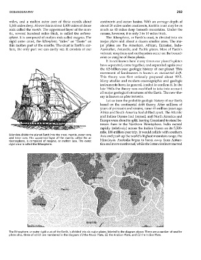
Scientists divide the planet Earth into the crust, mantle, outer (ore, Asia and push up the world's highest mountain range, the
and inner (ore. The uppermost layer of the mantle, called the as-
thenosphere, is composed of magma, or molten lava. The outer, Himalayas. Australia began to break away from Antarc-
rigid crust is called the lithosphere. tica and move northward, ·while the latter continent moved
The lithosphere, or outer rigid crust of the Earth, is divided into six major plates, labeled in the diagram above. There are a number of smaller
plates also, three of which are numbered in the diagram: (1) the Nazca Plate, (2) the Arabian Plate, and (3) the Indian Plate.