
Page 80 - Health, Population and Environment Education 10
P. 80
region has many famous cultural heritages like Pashupatinath, Swaymabunath, Baudha
Nath, Manakamana, Swargadwari, Palanchowk Bhagwati, Bindha basini, Dupcheshwor,
Ugratara, Deuti bajai, Tripura Sundari, Badimalika, Khaptad, Ramarosha, Shaileshwori
etc. As some major cities and capital city of Nepal lie in this region, it is linked with
road facilities across Nepal. Araniko Highway, B.P. Highway, Madan Bhandari Highway,
Prithivi Highway, Ratna Marga, Pasang Lamhu Highway, Bhupisherchan Highway,
etc. are situated in this region. Madhya Pahadi Lokmarga in this region connects Chiyo
Bhanjhang at panchthar in East to Jhulaghat at Baitadi in Far Western Region.
According to census 2011 A.D., 43% of total population in Nepal live in hilly region. There
is presence of many people in the big cities in this region. People have simple houses
to modern buildings in this region. They are constructed based on the geographical
conditions of a place. Houses are made of bricks, mud, tiles and cement. Some of the
houses are made of stone, soil or cement with roof covered by tiles or thatch. There is
construction of modern buildings with cement, rod and concrete using modern technology
in the big cities.
People in this region are involved in wide range of occupation. People cultivate varieties
of crops and vegetables in plateaus, valleys and hills. Many people are involved in
agriculture, animal husbandry, horticulture, floricultrue, tourism industry, trekking
industries and factories, business, trade, services, etc. In urban areas, people are involved
in business and enterprises.
Terai Region
Terai region lies in the southern part of Nepal which covers 23% of total area of Nepal. It
is also extended from east to west with the breadth of (25-30) km. It has hot and humid
climate. Based on land structure and climate of the terai region, there is diversity in plants,
animals, birds etc. and in the ecosystem.
Ecosystem of Terai, Region and its Related Aspects:
a. Physical Aspect
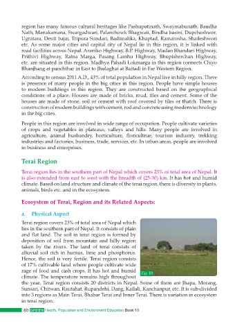
Terai region covers 23% of total area of Nepal which
lies in the southern part of Nepal. It consists of plain
and flat land. The soil in terai region is formed by
deposition of soil from mountain and hilly region
taken by the rivers. The land of terai consists of
alluvial soil rich in humus, lime and phosphorus.
Hence, the soil is very fertile. Terai region consists
of 17% cultivable land where people cultivate wide
rage of food and cash crops. It has hot and humid Fig: 10
climate. The temperature remains high throughout
the year. Terai region consists 20 districts in Nepal. Some of them are Jhapa, Morang,
Sunsari, Chitwan, Rautahat, Rupandehi, Dang, Kailali, Kanchanpur, etc. It is sub-divided
into 3 regions as Main Terai, Bhabar Terai and Inner Terai. There is variation in ecosystem
in terai region.
80 GREEN Health, Population and Environment Education Book-10