
Page 284 - (DK Eyewitness) Travel Guide - Morocco
P. 284
282 MOROC C O REGION B Y REGION
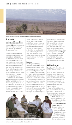
Majestic Jbel Ayachi, rising over extensive and sparsely populated desert plateaux
u Midelt as well as fossils and mineral passes through remote Berber
stones, are on sale in Souk hamlets. A turning off to the
Road Map D3. * 20,000. @ from
Meknès, Rabat, Erfoud, Er-Rachidia Jedid. There is also a workshop left, at the Mit Kane forestry
and Azrou. n Timnaï Cultural Centre, in Kasbah Myriem, on the road hut, leads back to Midelt.
20 km (12 miles) north of Midelt; to Tattiouine, where carpets, The track that continues west
(0535) 36 01 88. ( Wed & Sun. blankets and high-quality leads eventually to Imilchil.
_ Apple Festival (Oct). embroidery are produced. It Disused lead and silver mines
used to be run by Franciscan in the impressive Aouli Gorge,
On the border between the nuns who taught the local 25 km (15 miles) north east
High and Middle Atlas, Midelt Berber women these handicrafts, of Midelt, are sunk into the
is considered to be part of thus ensuring an income for mountainside. They were
southern Morocco. The small many families. abandoned in the 1980s, but
villages on each side of the the machinery is still in place.
road leading out of the town Environs
consist of traditional buildings The Cirque de Jaffar, a
that are very similar to those limestone gorge on the way out i Ziz Gorge
typical of southern Morocco. of Midelt, makes for the most Road Map D-E3. 88 km (55 miles)
While, at the beginning of the interesting tour here. However, south of Midelt on road N13.
20th century, Midelt was no the tracks that go there and
more than a modest ksar, under back, covering 79 km (49 miles), Wadi Ziz, which springs near
the Protectorate it became are tough going, being passable Agoudal, in the heart of the
a French garrison town. only from May to October and High Atlas, runs in an easterly
Located at the foot of Jbel only by four-wheel-drive vehicle. direction, then obliquely south,
Ayachi, which rises to a height The track along the hillside is level with the village of Rich.
of 3,737 m (12,264 ft), Midelt is overshadowed by the imposing It then carves a gorge in the
the starting point for tours. At outline of Jbel Ayachi, which mountains, irrigates the Tafilalt
an altitude of 1,500 m (4,923 ft), can be climbed without much then disappears into the
the town enjoys a continental difficulty. The Cirque de Jaffar is Saharan sands.
climate – very cold in winter set in a wild landscape of cedar, South of Midelt, beyond
and very hot in summer. oak and juniper growing in the Tizi-n-Talrhemt Pass, at an
Beautiful Middle Atlas carpets, stony ground. The winding track altitude of 1,907 m (6,259 ft),
forests give way to arid plains.
The fortified villages of the
Aït Idzerg tribe, as well
as a few old forts of the
French Foreign Legion,
line the road.
The Tunnel de Foum-
Zabel, or Tunnel
du Légionnaire, was
driven through
the limestone rock
here by the French
Foreign Legion in
1927, thus opening
a route to the south.
Berber women used to learn embroidery with the Franciscan sisters of Midelt The tunnel opens on
For hotels and restaurants see pp312–13 and pp329–30
282-283_EW_Morocco.indd 282 09/08/16 11:20 am
Eyewitness Travel LAYERS PRINTED:
Catalogue template “UK” LAYER
(Source v2.7)
Date 1st October 2013
Size 125mm x 217mm