
Page 190 - (DK Eyewitness) Travel Guide - Brittany
P. 190
188 BRIT T AN Y REGION B Y REGION
e Golfe du Morbihan
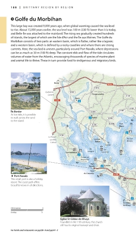
This large bay was created 9,000 years ago, when global warming caused the sea level
to rise. About 15,000 years earlier, the sea level was 100 m (330 ft) lower than it is today,
and Belle-Île was attached to the mainland. The rising sea gradually created hundreds
of islands, the largest of which are the Îsle d’Arz and the Île aux Moines. The Golfe du
Morbihan consists of two parts: an eastern basin, which is flatter, rather like a lagoon;
and a western basin, which is defined by a rocky coastline and where there are strong
currents. Here, the sea bed is uneven, particularly around Port-Navalo, where depressions
can be as much as 30 m (100 ft) deep. The constant ebb and flow of the tide circulates
volumes of water from the Atlantic, encouraging thousands of species of marine plant
and animal life to thrive. These in turn provide food for indigenous and migratory birds.
Auray
Quiberon,
Lorient Plougoumelen
Bono
Arradon
Auray
Île Berder
At low tide, it is possible
to walk across the sand Baden
to the island. Pointe
Port- d’Arradon
Blanc
La Trinité-
sur-Mer, Larmor- Île aux
Carnac Baden Île Moines
Berder
Île Île
Longue
Locmariaquer Gavrinis
Île
Godec
Pointe de
Kerpenhir
Port-
Navalo Arzon
Port
du Crouesty
. Port-Navalo
This small port is also a holiday
resort. The coast path offers
beautiful views in all directions.
St-Gildas-
de-Rhuys
0 kilometres 5
0 miles 3
Église St-Gildas-de-Rhuys
Founded in the 11th century, the church
still has its original transept and choir.
For hotels and restaurants see pp228–9 and pp241–3
188-189_EW_Brittany.indd 188 11/3/16 1:03 PM