
Page 223 - (DK Eyewitness) Travel Guide 2017 - Alaska
P. 223
ARC TIC AND WESTERN ALASK A 221
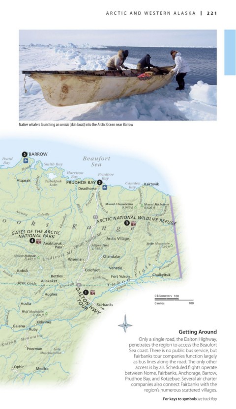
Native whalers launching an umiak (skin boat) into the Arctic Ocean near Barrow
BARROW
Peard Beaufort
Bay Smith Bay Sea
Wainwright Meade
Harrison Prudhoe
Bay
Atqasak Teshekpuk PRUDHOE BAY Bay
Lake Camden Kaktovik
Bay
Point Lay Utukok Deadhorse Hulahula
Ikpikpuk
Kukpowruk Kokolik Kuparuk Sagavanirktok 8,989 ft Mount Michelson
Mount Chamberlin
8,826 ft
Wevok Awuna Colville Itkilik Kongakut
Point Hope B r o o k s Chandler ARCTIC NATIONAL WILDLIFE REFUGE
NOATAK NATIONAL R a n g e Sheenjek
PRESERVE
Kukpuk
GATES OF THE ARCTIC
NATIONAL PARK
Chukchi Kivalina Noatak Tututalak Anaktuvuk Philip Smith Mt Arctic Village Spike Mountain
Mountain
Sea Noatak 4,460 ft Pass Atigun Pass 3,725 ft
4,735 ft
KOBUK VALLEY
CAPE KRUSENSTERN NATIONAL PARK Mount Igikpak E n d i c o t t M t Chandalar Coleen
NATIONAL MONUMENT 8,482 ft Wiseman
Kotzebue KOTZEBUE Ambler John Venetie Christian t s Porcupine
Sound Kiana Kobuk Coldfoot a
Fort Yukon
Shishmaref Goodhope Selawik Kobuk Bettles Y u k o n F l Chalkyitsik
Bay Allakaket Hodzana
BERING LAND BRIDGE Selawik Arctic Circle Koyukuk Yukon
Wales NATIONAL PRESERVE Kiwalik Lake Hogatza
Buckland Hughes 0 kilometers 100
Kougarok DALTON HWY
Port Teller Kuzitrin Tagagawik Huslia TOUR Fairbanks 0 miles 100
Clarence Koyuk Wolf Mountain
Council 4,960 ft
Koyuk s Koyukuk
Bering NOME Solomon Elim l l Galena Kokrines
i
GAMBELL Strait Norton H Nulato Ruby
Savoonga Bay Shaktoolik Getting Around
o
St. Lawrence Island Norton Sound t Kaltag Kaiyuh Mountains Only a single road, the Dalton Highway,
Camp Kulowiye Unalakleet a penetrates the region to access the Beaufort
l Poorman Lake Sea coast. There is no public bus service, but
Stebbins Minchumina
Pastol Bay u Yukon Fairbanks tour companies function largely
Bering Sea N
Kotlik Anvik as bus lines along the road. The only other
Emmonak Grayling Ophir Medfra access is by air. Scheduled flights operate
Sheldon Point between Nome, Fairbanks, Anchorage, Barrow,
Prudhoe Bay, and Kotzebue. Several air charter
companies also connect Fairbanks with the
Yukon
region’s numerous scattered villages.
For keys to symbols see back flap
220-221_EW_Alaska.indd 221 02/05/17 2:32 pm