
Page 225 - (DK Eyewitness) Travel Guide 2017 - Alaska
P. 225
ARC TIC AND WESTERN ALASK A 223
Tips for Drivers
Starting point: Livengood on
the Elliot Highway, 73 miles
(117 km) N of Fairbanks.
Length: 414 miles (662 km).
Accommodation: Coldfoot
at Mile 175 has a hotel and
café. There are campgrounds
at Marion Creek. Wiseman at
Mile 188.6 has lodging and a
general store. The Prudhoe Bay
Hotel in Deadhorse serves meals.
Note: there are only four gas
stations on the Dalton Highway –
at Yukon Crossing, Five-Mile
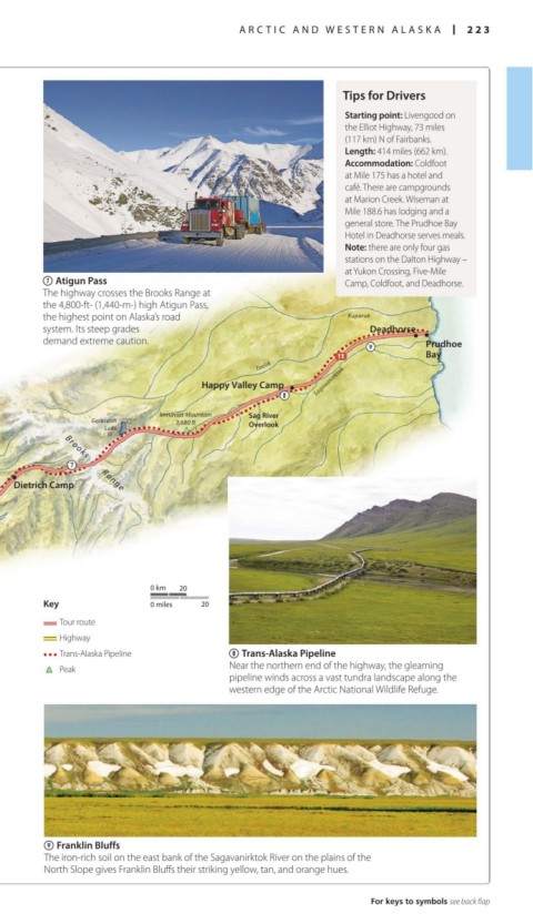
7 Atigun Pass Camp, Coldfoot, and Deadhorse.
The highway crosses the Brooks Range at
the 4,800-ft- (1,440-m-) high Atigun Pass,
the highest point on Alaska’s road Kuparuk
system. Its steep grades Deadhorse
demand extreme caution. Prudhoe
Bay
Toolik
Happy Valley Camp Sagavanirktok
Imnaviat Mountain Sag River
Galbraith 3,680 ft Overlook
Lake
Dietrich Camp
Brooks Range
Big Lake
0 km 20
Key 0 miles 20
Tour route
Highway
Trans-Alaska Pipeline 8 Trans-Alaska Pipeline
Peak Near the northern end of the highway, the gleaming
pipeline winds across a vast tundra landscape along the
western edge of the Arctic National Wildlife Refuge.
9 Franklin Bluffs
The iron-rich soil on the east bank of the Sagavanirktok River on the plains of the
North Slope gives Franklin Bluffs their striking yellow, tan, and orange hues.
For keys to symbols see back flap
222-223_EW_Alaska.indd 223 18/05/2017 11:12