
Page 678 - (DK Eyewitness) Travel Guide - India
P. 678
676 SOUTH INDIA
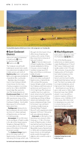
Ripening fields of paddy with the Eastern Ghats in the background, near Rajahmundry
0 East Godavari through the hilly Eastern Ghats, q Machilipatnam
District offers views of spec tacular Krishna district. 340 km (211 miles)
scenery, with a series of lakes
398 km (247 miles) E of Hyderabad that many find reminiscent of SE of Hyderabad. £ @ ( daily.
to Rajahmundry. ~ 10 km Italy and Scotland. One of the first European
(6 miles) from Rajahmundry. Ryali, 37 km (23 miles) south settlements on India’s eastern
£ Rajahmundry. @
of Rajahmundry, has a Chalukya coast, Machilipatnam (“City of
The Godavari, one of South temple dedicated to Vishnu. Fish”) was a thriving port and
India’s most sacred rivers, swells It houses a stone image of textile centre in the 17th and
to a wide torrent (at places 6 km/ Goddess Ganga (see p167), 18th centuries. It was also the
4 miles across), just north of from which flows a continuous headquarters of the English
Rajahmundry town. Lush paddy trickle of water. East India Company on the
fields and sugarcane plantations Draksharamam, located Coromandel Coast. The
characterize the countryside. 46 km (29 miles) southeast of French and the Dutch briefly
Rajahmundry, the largest Rajahmundry, is famed for its established themselves here as
town in East Godavari district, 10th-century Bhimeswara well. The Dutch cemetery, with
is best known for the many Swamy Temple, which combines its ornate tombstones, are all
Chalukya temples in its vicinity, the Chalukya and Chola styles of that remain from that period.
and for the 2,743-m (8,999-ft) architecture, and houses a 5-m Machilipatnam was hit by a
long bridge that spans the (16-ft) high linga. The Godavari giant tidal wave in 1864, which
river. The lookout points on is said to have been split into drowned more than 30,000
Dowleswaram Dam (built 1848– seven streams by the Saptarishis people. It was caused by a
52), 10 km (6 miles) downstream, (seven great sages) of Hindu volcanic eruption at Mount
offer spectacular views of the mythology and three of these Krakatoa, some 5,000 km (3,107
river. Every 12 years, the Dakshina streams are believed to have miles) away. After that it lost
Pushkaram festival – the Kumbh gone underground here. Close its importance as a port, but
Mela (see p215) of the South – to the town is an old Dutch it remains famous for its
takes place here. cemetery, locally known as kalamkari textiles (see p684).
Peddapuram, famous for its Ollandu Dibba (“Holland
fine handwoven silk and cotton, Mound”), with gravestones dated
is 43 km (27 miles) northeast between 1675 and 1728, some
of Rajahmundry, on the road with very elaborate designs.
to Visakhapatnam. Antarvedi, on the banks of the
Annavaram, 81 km (50 miles) Vashishta river, a branch of the
to the northeast of Rajahmundry, Godavari, is 112 km (70 miles)
is the site of the Satyanarayana south of Rajahmundry. It is best
Temple, on Ratnagiri Hill. It is reached by boat from Narsapur
renowned for its 4-m (13 ft)-high on the south bank. The Sri Laxmi
statue of the Hindu Trinity, and Narasimha Swamy Temple (built
its ancient sundial. in 1823), with its brightly painted
The Godavari Gorge begins tower, stands on the riverbank
80 km (50 miles) north of and is usually thronged with
Rajahmundry. A drive or boat pilgrims, who come for a dip in A kalamkari blockprinter at work
ride along the Gorge, which cuts the holy river. in Machilipatnam
For hotels and restaurants in this region see p703 and p719
676-677_EW_India.indd 676 26/04/17 11:50 am
Eyewitness Travel LAYERS PRINTED:
Catalogue template “UK” LAYER
(Source v2.6)
Date 12th July 2013
Size 125mm x 217mm