
Page 28 - GeoPRISMS_Newsletter_Spring2018_Neat
P. 28
SISIE: South Island Subduction
Initiation Experiment
Erin Hightower (Caltech) and Brandon Shuck (UT Austin)
he South Island Subduction Initiation Experiment (SISIE) was an international collaborative
active-source seismic survey of the Puysegur subduction margin conducted aboard the R/V Marcus
TG. Langseth with researchers and graduate students from Caltech, the University of Texas, Texas
A&M University, Victoria University of Wellington, and the University of Otago, NZ. The SISIE hopes to
further our understanding of the processes controlling subduction initiation, which remains one of the
last unsolved problems in plate tectonics. There are many existing hypotheses and models that attempt
to quantify and understand these processes, but while many of them are plausible, our ideas far outrun
our data. Geodynamic modeling of subduction initiation can only go so far in accurately explaining the
mechanics and dynamics of the process. Therefore, without sufficient data to substantiate these models,
there is no definitive answer to how subduction zones form.
The Puysegur Trench is part of the Pacific-Australian plate boundary and is a uniquely situated margin for
such a survey because it is a young subduction zone with a well-constrained kinematic history that currently
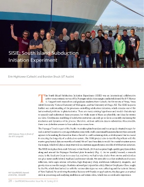
SISIE Science Party in front of appears to be making the transition from a forced to a self-sustaining state, a development that is crucial
the R/V Langseth.
in ensuring the longevity of a subduction system. The SISIE project aims to test this hypothesis with the
marine geophysical data we recently collected. We will use these data to model the crustal structure across
the margin, which will play an important role in constraining geodynamic models of subduction initiation.
The SISIE took place from mid-February to late March, 2018 and acquired high-quality geophysical data
along and around the Puysegur-Fiordland plate boundary (Fig. 1). As we quickly learned, a research
cruise in the Southern Ocean is no easy feat, and twice we had to take shelter from storms and relentless
ten-plus meter swells behind Auckland and Stewart islands. We were able to collect multichannel seismic
reflection, wide-angle seismic refraction, high-frequency chirp, multibeam bathymetry, magnetic, and
gravity data across the margin. Students onboard participated in a daily Marine Geophysics Class, taught
by the PIs, which familiarized us with the various data types we were collecting and the tectonic history
NSF GeoPRISMS Awards of New Zealand. By combining theoretical lectures with hands-on applications, the class gave us practical
#1654766, 1654689 skills in processing and analyzing multibeam and seismic data, which was an invaluable experience.
28 • GeoPRISMS Newsletter Issue No. 40 Spring 2018