
Page 280 - (DK Eyewitness) Travel Guide - The Netherlands
P. 280
278 NOR THERN AND EASTERN NE THERLANDS
olden days cattle with intriguing names such as
were let out to graze Hee, Horp and Kaart, which date
everywhere (“oerol”). back to when the Frisians
This is where the settled on the islands. The
Oerol Festival, held hamlet with the kerkhof van
each year in June, Striep cemetery is where the
gets its name. first church on the island was
In Formerum, West, built, in the 10th century. Its
and Hoorn, the dunes outline is still visible. Further
have been planted eastwards is Hoorn, with
with coniferous and 13th-century Gothic-
deciduous woods. In Romanesque St Janskerk
the south are polders, standing on the site of the
and beyond the dykes original church.
are the salt marshes.
There is a nature E Museum ‘t Behouden Huys
reserve at either end Commandeurstraat 32, West-
of the island: the Terschelling. Tel 0562-442389.
Noordvaarder in the Open Apr–Oct: 10am–5pm Tue–Fri,
west, and the 1–5pm Sat & Sun; Nov–Mar: 1–5pm
Boschplaat in the Wed, Sat & Sun.&
east. If you happen to E Centrum voor Natuur
be sailing over from en Landschap
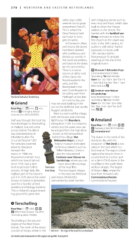
The Oerol Festival on Terschelling Harlingen at low tide Burg. Reedekerstraat 11, West-
on a sunny day, you Terschelling. Tel 0562-442390.
7 Griend may see seals basking in the Open Apr–Oct: 9am–5pm daily;
sun on the de Richel and Jacobs Nov–Mar: 11am–5pm Tue, Sat &
Road Map C1. * none. 8 very Ruggen sandbanks. Sun. & 7
limited. n Vereniging Natuur-
monumenten (035-6559933). West is a real mud-flat village,
with old houses and a famous
Half-way through the boat trip lighthouse, the Brandaris, 9 Ameland
from Harlingen to Terschelling dating from 1594. It is closed to Road Map C/D1. * 3,500. g @
or Vlieland, one will come visitors, but the same view can n Bureweg 2, Nes (0519-546546).
across Griend. The island be enjoyed from the high dune ∑ vvvameland.nl
was abandoned by its known as the Seinpaalduin
inhabitants after the behind the village. Het The dunes in the north of this
St Lucia’s flood of 1287. Behouden Huys is a local island are dry, with the
For centuries it seemed history museum dedicated exception of Het Oerd, a wet
about to disappear to famous islanders such as valley in the east which is a
beneath the Willem Barentsz; there is bird reserve. The region is best
waves. In 1988, the also the educational explored by bicycle; there is
Natuurmonumenten trust, Centrum voor Natuur en a cycle track to a scenic spot
which has leased Griend Landschap, where you can on a 24-m (79-ft) dune. In the
since 1916, had a dam learn about the ecology mud flats in the south there
built to prevent further Tombstone of the mud flats. are four villages. The largest
erosion. At high tide, the from Striep The two largest villages of these is Nes, where the
highest part of the island is in the west are Midsland boat from Holwerd calls.
just 1 m (3 ft) above the water. and Hoorn. Midsland is Commandeurshuizen
Access to Griend is forbidden, surrounded by small hamlets (commodores’ houses)
save for a handful of bird
wardens and biology stu dents.
This is Holland’s largest breed-
ing ground for great tern.
8 Terschelling
Road Map C1. * 4,900. g @
n Willem Barentszkade 19a, West-
Terschelling (0562-443000).
Terschelling is the second-
largest of the West Frisian
Islands. The north of the island
consists of dunes, where in the Het Oerd – the edge of the mud flats on Ameland
For hotels and restaurants in this region see pp398–9 and p412
278-279_EW_Netherlands.indd 278 14/03/2017 15:04
Eyewitness Travel LAYERS PRINTED:
Catalogue template “UK” LAYER
(Source v2.4)
Date 25th April 2013
Size 125mm x 217mm