
Page 193 - NAVAL SCIENCE 3 TEXTBOOK
P. 193
MAR!NE NAV!GATION 199
Because of GPS, loran coverage is no longer available in much
~, "",~ of the world. But in areas it does cover, mostly in and around North
,
'" , , .' America, it is a highly reliable system stiJI used by many, including
-. ............ -1 signals are not receivable. The Department of Homeland Security
JUW. _________ .:~ first responders to emergencies in places where the weaker CPS
has proposed keeping an upgraded enhanced version of the sys-
tem (eLoran) in operation in the United States as a hack-up to
GPS, and the British government has proposed the same for areas
N around the British Isles.
i developed by the United States is the Global Positioning System
GPS. The newest electronic navigation system to have been
(CPS). It consists of a constellation of some twenty-four opera-
tional satellites circling the Earth in lO,900-mile-high circular
orbits, and their supporting ground stations. GPS can provide con-
tinuous three-dimensional positioning data on land, sea, and air,
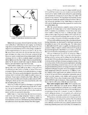
A radar PPI presentation oriented to true north. accurate to within ±10 meters (132.8 feet) everywhere on Earth.
GPS can yield even better accuracy when corrections to its posi-
tioning information are determined by land-based receivers and
Radar. Radar, an acronym derived limn the first letters of each
transmitted to users in the surrounding area. This enhancement
word in the phrase "radio detection and ranging," was developed
is called differelltinl GPS, and it is capable of producing positions
originally as a means for detecting surface ships and aircraft. Ll;ter
accurate to within ±1 meter (13.28 feet). Differential GPS signals are
improvements and refinements led to its becoming a valuable elec-
broadcast throughout the United States by transmitters operated by
tronic navigational device. Its operation is based on the fact that,
the Coast Guard, and by many foreign governments worldwide.
like sound waves, radio ·waves are reflected from solid objects. Its
GPS has revolutionized the practice of navigation. ''''hen it
great advantage over other means of electronic navigation is that
became fully operational in 1994, it was at first used for position-
it does not require external transmitting stations. Radar's chief dis-
finding mainly by mariners and the military. But since then its use
advantage, however, is that its maximulll range is currently lim-
has exploded. (iPS is now the basis of operation of a wide variety of
ited to slightly more than line-of-sight. Extensive research has been
electronic plotters and high-tech marine navigation systems. It has
under way for years to e~,'tend radar ranges to distances over the
an amazing variety of civil and commercial applications, including
horizon. and some breakthroughs have been made.
navigation and tracking systems for boats, cars and trucks, aircraft
Radar involves sending out a narrow beam of very high fre-
navigation and landing systems, surveying, and m.uch more. [vIany
quency radio waves. Upon striking any object in their path, they
cell phones and laptop computers now come equipped with GPS-
are reflected and return to the transmitter as "echoes." Exact mea-
based navigational systems for personal use. In addition to posi-
surement of the time of return of each yields the distance, or range,
tion finding, military applications now include hands-off control
to the object. The bearing can be determined by the position of the
of aircraft and ground vehicles, and guidance systems for many of
antenna, which is indicated with a bright line called a sweep on a
today's precision ·weapons, cruise missiles, and unmanned aerial
radarscope. Targets appear as bright spots of light, called pips. The
yehicles (UAVs). There is also a Russian version of the GPS system
form of scope 1110st often used is the plan position indicator (PPI),
called GLONASS under development, whose capabilities may rival
which gives a bird's eye view of the area covered by the radar, with
those of the U.S. GPS system within the next several years,
the transmitting ship in the center.
Ship's inertial navigation system (SINS). SINS is mainly a navi-
Radar has a number of important advantages as a navigational
gational aid for subrnarines and aircraft carriers, although mod-
device. It can be used at night and during periods of low visibil-
ern more compact models are coming into use in smaller vessels,
ity. A fix can be obtained from a single object. It is very accurate
AUVs, land vehicles, and aircraft. In essence SINS uses highly pre-
and rapid. It can also be used to locate and track other vessels and
cise gyroscopes along with a computer to track the platform's
storms, and thus is important for ship safety.
motion with great accuracy. It is a completely self-contained sys-
Loran. Loran is a term derived from the first letter(s) in each
tem, so it would be an especially valuable \vartime navigation aid.
word of the term "long range navigation." Loran is a system of
SINS produces extremely accurate and continuous dead reck-
radio signals broadcast by groups of transmitting stations of
oning positions from the last good fix position. The DR positions
known position. A loran fix is determined by a loran receiver from
can be displayed on an electronic chart, along with the desired
the intersection of lines of position obtained from these signals.
track. Although most SINS systems are routinely updated every fe\v
hours using external systems such as GPS, they can maintain accu-