
Page 537 - 9780077418427.pdf
P. 537
/Users/user-f465/Desktop
tiL12214_ch20_501-520.indd Page 514 9/3/10 6:24 PM user-f465
tiL12214_ch20_501-520.indd Page 514 9/3/10 6:24 PM user-f465 /Users/user-f465/Desktop
People Behind the Science
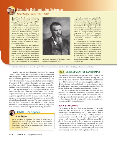
John Wesley Powell (1834–1902)
ohn Wesley Powell was the most roman- Powell’s enormous and original studies
Jtic figure in nineteenth-century U.S. produced lasting insights on fluvial erosion,
geology. The son of intensely pious Meth- volcanism, isostasy, and orogeny. His great-
odist immigrants, Powell was intended by ness as a geologist and geomorphologist
his farmer father for the Methodist min- stemmed from his capacity to grasp the
istry, but early on he developed a love for inter connections of geological and climatic
natural history. In the 1850s, he became causes. In 1881, he was appointed director
secretary of the Illinois Society of Natural of the U.S. Geological Survey. He encour-
History, traveling widely and building up aged most of the great U.S. geologists
his natural history collections and his geo- of the next generation, including Grove
logical expertise. While he was fighting in Karl Gilbert, Clarence E. Dutton, and
the Civil War, his right arm was shot off, W. H. Holmes.
but he continued in the service, rising to Powell drew attention to the aridity of
the rank of colonel. the American southwest and for a couple
After the end of the war, Powell oc- of decades campaigned for massive funds
cupied various chairs in geology in Illinois, for irrigation projects and dams and for
while continuing with intrepid fieldwork (he the geological surveys necessary to imple-
was one of the first to steer a way down the ment adequate water strategies. He also as-
Grand Canyon). In 1870, Congress appointed serted the need in the drylands for changes
him to lead an official survey of the natural in land policy and farming techniques.
resources of the Utah, Colorado, and Arizona Failing to win political support on such
area, the findings of which were published (1875) and The Geology of the Eastern Portion matters, he resigned in 1894 from the Geo-
in his The Exploration of the Colorado River of the Uinta Mountains (1876). logical Survey.
Source: From the Hutchinson Dictionary of Scientific Biography. © Research Machines plc 2003. All Rights Reserved. Helicon Publishing is a division of Research Machines.
Another common wind deposit is called loess (pronounced 20.5 DEVELOPMENT OF LANDSCAPES
“luss”). Loess is a very fine dust, or silt, that has been deposited The landscape provides interesting scenery with a variety of fea-
over a large area. One such area is located in the central part of tures such as mountains, valleys, and broad, rolling hills. The
the United States, particularly to the east sides of the major riv- features of Earth’s surface are called landforms. Landforms in-
ers of the Mississippi basin. Apparently, this deposit originated clude (1) broad features such as a mountain, plain, or plateau and
from the rock flour produced during the last great ice age. The (2) minor features such as a hill, valley, or canyon. Broad or minor,
rock flour was probably deposited along the major river valleys all landforms are temporary expressions between the forces that
and later moved eastward by the prevailing westerly winds. Since elevate the land and the weathering and erosion that level it.
rock flour is produced by the mechanical grinding action of gla- No two landforms are identical because each has been
ciers, it has not been chemically broken down. Thus, the loess produced and sculptured by a variety of processes. Thus, there
deposit contains many minerals that were not leached out of the is no exact way to describe how a particular landform came to
deposit as typically occurs with chemical weathering. It also has be, but generalizations are possible. Generalizations are based
an open, porous structure since it does not have as much of the on three factors: (1) rock structure, (2) weathering and erosion
chemically produced clay minerals. The good moisture-holding processes, and (3) stages of erosion.
capacity from this open structure, together with the presence
of minerals that serve as plant nutrients, makes farming on the ROCK STRUCTURE
soils developed from these deposits particularly productive.
The structure of the rocks determines the shape of the minor
landforms. Structure refers to the (1) type of rocks (igneous,
CONCEPTS Applied metamorphic, or sedimentary) and (2) their attitude, that is,
if they have been disturbed by faulting or folding. The type of
Dune Angles rock determines how well a rock resists weathering. The sedi-
Use a protractor to measure the slopes in a sand dune. mentary rock limestone, for example, is highly susceptible to
Com pare the angle of the slope made by sand moving chemical weathering, while the metamorphic rock quartzite is
upslope to the angle of the slope where sand moves highly resistant to chemical weathering. The attitude of the rock
downslope. Investigate what factors seem to influence the also determines how well a rock resists weathering and erosion.
steepness of the slopes. Limestone beds that have been faulted and folded, for example,
are more easily eroded than flat-lying beds of limestone.
514 CHAPTER 20 Shaping Earth’s Surface 20-14