
Page 188 - (DK) Ocean - The Definitive Visual Guide
P. 188
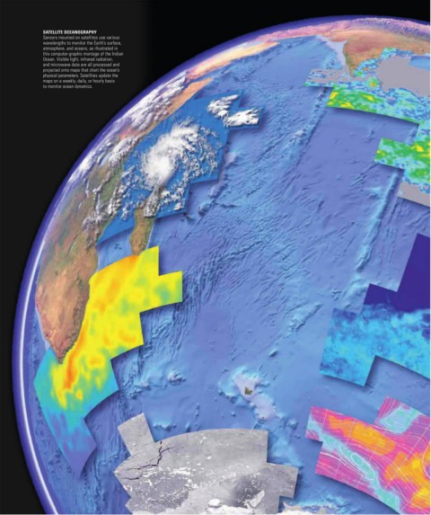
SATELLITE OCEANOGRAPHY
               Sensors mounted on satellites use various
               wavelengths to monitor the Earth’s surface,
               atmosphere, and oceans, as illustrated in
               this computer-graphic montage of the Indian
               Ocean. Visible light, infrared radiation,
               and microwave data are all processed and
               projected onto maps that chart the ocean’s
               physical parameters. Satellites update the
               maps on a weekly, daily, or hourly basis
               to monitor ocean dynamics.