
Page 444 - (DK) Ocean - The Definitive Visual Guide
P. 444
442 THE ATLANTIC OCEAN
The Central Atlantic
THE MID-ATLANTIC RIDGE, THE WORLD’S LONGEST mountain
chain, is the main sea-floor feature in the central Atlantic. Either
side of the ridge are two flat abyssal plains, the Angola and
Brazil basins. The dominant Atlantic gyres meet in the central
Atlantic. Both are westward-flowing near the Equator, but are
separated by the Equatorial Countercurrent, a strong eastward
surface flow, and the Equatorial Undercurrent, an even stronger ATLANTIC OCEAN G3 ASCENSION ISLAND
Rising just to the west of the Mid-Atlantic
flow 330 ft (100 m) deep. The Mid-Atlantic Ridge Ridge, Ascension Island has 44 distinct
Canaries Current flows south volcanic craters.
along the North African coast, LENGTH 6,200 miles (10,000 km)
AVERAGE HEIGHT ABOVE SEA FLOOR 9,800 ft (3,000 m) sea floor gets deeper and older away
becoming the North Equatorial from the centre, and smoother as its
RATE OF SPREAD 1–2 in (2–5 cm) per year
Current. In the south, the cold features are covered in sediments.
The Mid-Atlantic Ridge dissects the The featureless abyssal plains of the
Benguela Current flows up
entire length of the Atlantic in a series Angola and Brazil basins lie to the
the African coast, then away of rifts and fractures. In the central east and west respectively. The ridge
from the coast as the South Atlantic, with relatively narrow is displaced east–west at numerous
continental shelves, it is easy to see points by transform faults, where the
Equatorial Current. This where the coasts on either side of the African and South American plates
current splits where it reaches ocean were once joined. The ridge are moving past each other. These
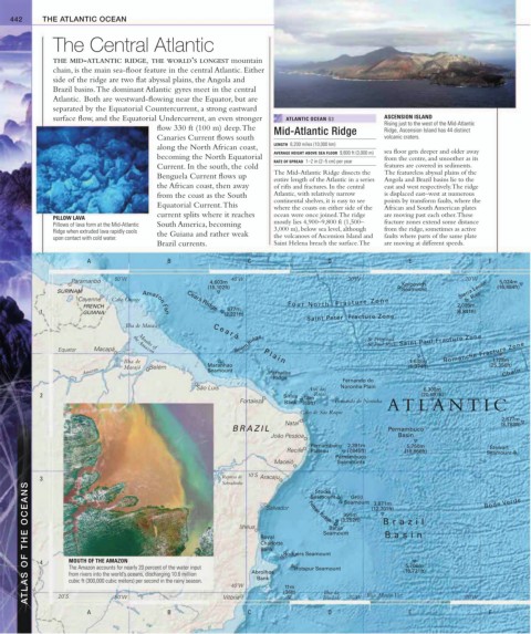
PILLOW LAVA
Pillows of lava form at the Mid-Atlantic South America, becoming mostly lies 4,900–9,800 ft (1,500– fracture zones extend some distance
Ridge when extruded lava rapidly cools the Guiana and rather weak 3,000 m), below sea level, although from the ridge, sometimes as active
upon contact with cold water. the volcanoes of Ascension Island and faults where parts of the same plate
Brazil currents. Saint Helena breach the surface. The are moving at different speeds.
A B C D E F
Paramaribo 50˚W 4,603m 40˚W 30˚W Knipovich 20˚W 5,024m
(15,102ft) (16,484ft)
SURINAM Seamount Sierra Leone
Cayenne Cabo Orange Ceará Ridge F o u r N o r t h F r a c t u r e Z o n e Rise
FRENCH Amazon Fan 2,085m
677m
1 GUIANA (2,221ft) (6,841ft)
Saint Peter Fracture Zone
Ilha de Maracá
Belém Ridge St Peter and Saint Paul Fracture Zone
St Paul Rocks
Mouths of
Equator Macapá Romanche Fracture Zone
the Amazon
7,728m
Ilha de Maranhao 1,638m (25,356ft)
C e a r á P l a i n
Amazon Marajó Belém Seamount Parnaíba (5,374ft) Chain
Ridge
Fernando do
São Luís Atol das Noronha Plain 6,308m
2 Sirius 18m Rocas (20,697ft)
Fortaleza Bank (59ft) Fernando do Noronha ATLANTIC
Cabo de São Roque
2,677m
Natal (8,783ft)
BRAZIL Pernambuco
João Pessoa Basin
Pernambuco 2,391m 5,750m Stewart
Recife Plateau (7,845ft) (18,866ft) Seamount
Pernambuco
Maceió Seamounts
3 Represa de 10˚S Aracaju Ferraz Ridge Seamount 3,871m Bode Verde
Sobradinho
ATLAS OF THE OCEANS 4 MOUTH OF THE AMAZON Ilhéus Royal Rodgers Seamount Bahia (3,252ft) Brazil
Stocks
Seamount
Gröll
Salvador
(12,701ft)
991m
Seamount
Basin
Charlotte
Bank
5,706m
The Amazon accounts for nearly 20 percent of the water input
Hotspur Seamount
(18,721ft)
Abrolhos
from rivers into the world’s oceans, discharging 10.6 million
cubic ft (300,000 cubic meters) per second in the rainy season.
40˚W
11m
Ilha da
20˚S
A 50˚W B Vitória C Bank (36ft) Trindade 30˚W Ilhas Martin Vaz E 20˚W F
D