Page 482 - (DK) Ocean - The Definitive Visual Guide
P. 482

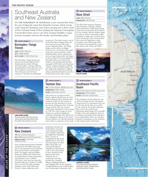
480     THE PACIFIC OCEAN                                                                                        A               B

                                                                                                                   150˚E
               Southeast Australia                                            PACIFIC OCEAN B6                      Coral Sea Islands  Mellish
                                                                           Bass Strait                                                Rise
               and New Zealand                                             LENGTH  400km (250 miles)       1

                                                                           MINIMUM WIDTH  100km (62 miles)                 Coral Sea
               TO THE NORTHEAST OF AUSTRALIA, ocean currents flow from
               the east, feeding the warm East Australia Current, which sweeps   The Bass Strait separates Tasmania
                                                                           from Australia, overlying a shallow   20˚S
               south along the Australian coast, before turning east to flow north   shelf around 50m (160ft) deep. Strong   Great Barrier Reef
               of New Zealand. South of New Zealand, the Antarctic Circumpolar   winds and currents from the Southern   Mackay
               Current flows from west to east. New Zealand straddles a major   Ocean combine with the shallow depth
                                                                           to make its waters notoriously rough.
               tectonic boundary between the Pacific and Australian plates.
                                                                           Hundreds of ships were wrecked on its
                                                                                                           2
                                                                           shores during the 19th century, before
                                             motion yet.  The older oceanic crust of   the erection of lighthouses made
                  PACIFIC OCEAN G4                                                                              Tropic of Capricorn
                                             the Pacific Plate is sinking below the   navigation safer. Natural gas fields
               Kermadec–Tonga                more buoyant crust of the young   were discovered beneath the eastern                    Fraser
                                             oceanic Australian Plate.  The Tonga   Bass Strait in the 1960s and 1990s.               Island
               Trench                        Ridge and the older Lau Ridge
                                             formed as arcs of volcanoes. The rapid
               LENGTH  2,500km (1,550 miles)
                                             motion has caused extension of the                                                 Brisbane
               DEPTH  10,800m (35,430ft)     Australian Plate and the opening of a                                                       Gold
               RATE OF CLOSURE  15–24cm (6–9in) per year  back-arc basin between the two ridges,                                         Coast
                                             in the Lau Basin. The latest addition to
               The Kermadec–Tonga Trench runs   this island chain is new land at the
               between the North Island of New   southern end of Hunga Ha’apai that
               Zealand and the island of Tonga.    emerged in 2009 after several undersea
               The Pacific Plate converges with the   volcanic eruptions. Together with Fiji
               Australian Plate in this suduction zone.   and Samoa, the 36 islands of Tonga are
               At its northern end, closure rates of   the cradle of the Polynesian seafaring                   30˚S
               24cm (9in) per year have been   culture, which had stretched across the                               AUSTRALIA
               measured – the fastest recorded plate   South Pacific by the 12th century.  PHILLIP ISLAND
                                                                                                                              Newcastle
                                                                                                           4
                                                PACIFIC OCEAN C5              PACIFIC OCEAN H3                                  Sydney
                                             Tasman Sea                    Southwest Pacific                               Wollongong
                                             AREA  2.3 million square km  (890,000 square miles)  Basin
                                             MAXIMUM DEPTH  5,945m (19,500ft)                                                            Tasman  Plain
                                                                           AREA  23 million square km  (8.9 million square miles)
                                             INFLOWS  Southern Ocean, Coral Sea
                                                                           MAXIMUM DEPTH  5,655m (18,500ft)
                                             This warm sea was discovered by   INFLOWS  Pacific Ocean, Southern Ocean
                                             Dutch explorer Abel Tasman in 1642,                           5                       Cape
                                             while looking for Terra Australis (the   The Southwest Pacific Basin lies east        Everard
                                                                                                                 Melbourne
                                             Southern Land). On this voyage he   of New Zealand and the  Kermadec–           2,620m
                                             become the first European to reach   Tonga Trench. It is bounded in the east   (8,596ft)
                                             the islands of Tasmania, New Zealand,   by the East Pacific Rise (see p.478),    South East Point
                                             Tonga, and Fiji. The area was not   in the south by the Pacific–Antarctic   Cape Otway  Furneaux
                                             visited again until James Cook’s voyage  Rise, and in the north by the      Bass Strait  Group
                                             in 1768. On a later voyage, in 1644,   Polynesian island chains. The Louisville
                                                                                                                    King
                                             Tasman succeeded in finding the   Ridge is the only significant chain of   40˚S  Island
               LORD HOWE ISLAND              continent of Australia. The Tasman Sea   seamounts and much of the basin floor   Tasmania
               The warm waters of the East Australia    has a subtropical climate in the north,   is an abyssal plain. There are extensive   6
               Current allow Lord Howe Island to host    but the influence of cold sub-Antarctic  deposits of manganese in the northern   Hobart
               the world’s most southerly coral reef.  water makes it temperate in the south.  and southern parts of the basin.         East
                                                                                                                       3,460m          Tasman
                                                                                                                       (11,352t)       Plateau
                                             producing volcanism on
                  PACIFIC OCEAN E5
                                             North Island, and south
               New Zealand                   as the Macquarie Ridge,
                                                                                                                                    730m
                                             where shallow subduction                                            140˚E             (2,395ft)
                                             has uplifted the Australian
               TYPE  Micro-continental island group
        ATLAS OF THE OCEANS  New Zealand separated from Australia   2012, the largest of which             7     50˚S              Tasman Fracture Zone
                                                                                                                                    Tasman
                                             Plate. A swarm of
               AREA  268,680 square km (103,700 square miles)
                                                                                                                                    Plateau
                                             earthquakes hit the South
               NUMBER OF ISLANDS  2 main islands
                                             Island between 2010 and
               (700 smaller islands)
                                             killed 185 people and
               and Antarctica 80 million years ago,
                                             destroyed the historic
                                             cathedral in Christchurch
               and is now positioned at the boundary
               between the Pacific and Australian
                                             in 2011. The main islands
                                             of New Zealand are the
               plates. The largely transverse Alpine
                                             highest points of an
               Fault runs 700km (435 miles) across
                                             extensive area of
               the South Island. Crustal compression
               and distortion across a 250km-
                                             continental crust that
               (155-mile-) wide zone has raised the
                                             includes the Campbell
               Southern Alps over 4,000m (13,000ft)
                                             Plateau, Challenger Plateau,
                                                                           CAMPBELL ISLAND
               above sea level. The plate boundary
                                             and Chatham Rise. To the southeast,
                                                                           The southernmost of New Zealand’s
               continues north as the Hikurangi
                                             Campbell Plateau is the world’s largest
                                                                           subantarctic islands, Campbell Island
               Trench, a classic subduction zone
                                                                           is primarily volcanic in origin.
                                             area of submerged continental crust.
                                                                                                                    A     140˚E      B
   477   478   479   480   481   482   483   484   485   486   487