Page 118 - (DK) Ocean - The Definitive Visual Guide
P. 118

116     COASTS AND THE SEASHORE


                  ATLANTIC OCEAN NORTHWEST
               St. Lawrence Estuary

                              TYPE  Salt-wedge
                              (river-dominated)
                              estuary
                              AREA  Approximately
                              10,000 square miles
                              (25,000 square km)
               LOCATION  Quebec, eastern Canada
               The St. Lawrence Estuary is one of
               the world’s largest estuaries. Some
               500 miles (800 km) long, it discharges
               about 3 million gallons (12 million
               liters) of water into the Gulf of
               St. Lawrence each second. The estuary
               is rich in marine life. In its wide
               middle and lower reaches, the icy
               Labrador Current flows 1,000 ft
               (300 m) below the surface in the
               opposite direction of the main
               estuarine flow. In one section, near
               the mouth of a fjord that branches
               off the estuary, the current’s nutrient-
               rich waters rise abruptly and mix
               with warmer waters above. This
               upwelling of nutrients encourages
               plankton growth, providing the base
               of a food chain that involves many
               species of fish and birds, and a small
               population of beluga whales.
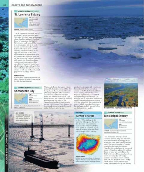
               WINTER SCENE
               In winter, much of the estuary becomes iced
               over. A stretch of the estuary is seen here at
               low tide, shortly after sunrise.


                  ATLANTIC OCEAN NORTHWEST   Chesapeake Bay is the largest estuary   productive, though it still yields more
                                             in the US. Its main course, fed by the   fish and shellfish than any other
               Chesapeake Bay                Susquehanna River, is over 185 miles   estuary in the US. Industrial and farm
                                             (300 km) in length. It has numerous   waste running into the bay causes
                              TYPE           sub-estuaries, and more than 150   frequent algal blooms, which block
                              Partially mixed
                              estuary        rivers and streams drain into it. This   sunlight from parts of its bed. The
                                             body of water was created by sea-level   resulting loss of vegetation has lowered
                              AREA
                              3,200 square miles   rise drowning the valley of the   oxygen levels in some areas, severely
                              (8,200 square km)   Susquehanna and its tributaries over   affecting animal life. The depletion of
                                             the last 15,000 years. Once famous for   oysters, which naturally filter water,
               LOCATION   Surrounded by Maryland and parts of   its seafood, such as oysters, clams, and   has had a particularly harmful effect
               eastern Virginia, US          crabs, the bay is now far less   on the bay’s water quality.   MAIN CHANNEL FLOWING THROUGH DELTA

                 BAY BRIDGE                                                 DISCOVERY                       ATLANTIC OCEAN WEST
                 A major bridge in the upper                                IMPACT CRATER
                 bay connects Maryland’s                                                                Mississippi Estuary
                 rural eastern shore to its                                                                            TYPE
                 urban western shore.                                       In the 1990s, drilling of the              Salt-wedge
                                                                            seabed at Chesapeake Bay led to            (river-dominated) estuary
                                                                            the discovery of a meteorite               AREA
                                                                            impact crater 53 miles (85 km)             25 square miles
                                                                            wide under its southern region.            (60 square km)
                                                                            The 35-million-year-old crater   LOCATION  Southeastern Mississippi Delta,
        OCEAN ENVIRONMENTS                                                  SHOCKED QUARTZ              30 miles (50 km) long and lies at the
                                                                            helped shape today’s estuary.
                                                                                                        southeastern Louisiana, US
                                                                                                        The Mississippi Estuary is about

                                                                                                        seaward end of the Mississippi River,
                                                                                                        where the river flows through its own
                                                                                                        delta. The estuary consists of a main
                                                                                                        channel and several subchannels.
                                                                                                        Together, these discharge an average of
                                                                                                        some 4.75 million gallons (18 million
                                                                                                        liters) of water per second into the
                                                                                                        Gulf of Mexico. The main channel is a
                                                                                                        classic example of a salt-wedge
                                                                                                        estuary—its surface waters contain
                                                                            Evidence for the crater included the discovery
                                                                                                        little salt, but they flow over a wedge
                                                                            of grains of shocked quartz, which forms when
                                                                                                        of salt water, which extends deep
                                                                            intense pressure alters its crystalline structure.
                                                                                                        down for several miles up the estuary.
   113   114   115   116   117   118   119   120   121   122   123