
Page 124 - (DK) Ocean - The Definitive Visual Guide
P. 124
122 COASTS AND THE SEASHORE
PACIFIC OCEAN WEST 10 million litres (2.2 million gallons)
of water per second into the South
Pearl River Estuary China Sea. Mostly less than 9m (30ft)
deep, but containing some deeper
TYPE dredged channels, the Pearl River
Salt-wedge
(river-dominated) estuary Estuary has a tidal range of 1–2m
(3–6ft). It drains water from one of the
AREA
1,200 square km most densely urbanized regions in the
(450 square miles) world and is severely polluted as a
result of billions of tonnes of sewage
LOCATION Northwest of Hong Kong, Guangdong, and industrial effluent entering it each
southeastern China year. One result of this has been the
increasing occurrence of algal blooms
The bell-shaped Pearl River Estuary that threaten local fishing. Pollution is
receives and carries most of the also a threat to a dwindling population
outflow from the Pearl River, the of Chinese White Dolphins (less than
common name for a complex system 1,000) that live in the estuary. Only
of rivers in the southern Chinese since 2008 have efforts begun to
province of Guangdong. The estuary reduce pollution through the building
is nearly 60km (37 miles) long, and its of more water treatment plants.
width increases from
20km (12 miles) at its
head to about 50km
INDIAN OCEAN SOUTHEAST DEEP GULF (30 miles) at its
Spencer Gulf is the larger wedge-shaped mouth. To the north
Northern Spencer coastal indent visible in this satellite image. and west of the
The desert around its head helps produce the estuary is a delta,
Gulf Estuary estuary’s unusual circulation pattern. formed from the
confluence of the Xi
TYPE
Inverse estuary In a reverse of the usual pattern, this Jiang and other rivers
estuary’s waters become saltier towards of the Pearl River
AREA
Approximately it head, away from its mouth. This system. Together,
5,000 square km is because its head is surrounded by these rivers discharge
(2,000 square miles)
hot desert and loses more water to an average of
evaporation than enters it from rivers.
LOCATION Northwest of Adelaide, South Australia
The head’s high salinity means that it GUANGZHOU
draws in from the mouth ocean water Formerly known as
The estuary in the north of Australia’s of lower salinity than the water drawn Canton, this large and
Spencer Gulf is classified as an inverse in by a typical estuary. The estuary is busy port city lies on a
estuary, owing to its unusual pattern of surrounded by extensive tidal flats, northerly extension of the
salt distribution and water circulation. seagrass banks, and mangroves. Pearl River Estuary.
PACIFIC OCEAN WEST The Yangtze Estuary is the lower,
tide-affected part of the Yangtze (or
Yangtze Estuary Changjiang) – the longest river in Asia
and the third longest in the world. The
TYPE estuary occupies 700km (430 miles)
Partially mixed
estuary of the river’s 6,300-km (3,900-mile)
length. Near its mouth, it splits into
AREA
2,500 square km three smaller rivers and numerous
(1,000 square miles) streams that run through a delta. Here,
silt deposition continually creates new
LOCATION Northwest of Shanghai, eastern China land, which is used for agriculture.
The estuary carries an average of
30 million litres (6.6 million gallons)
of water per second into the East China
Sea; its average depth is 7m (23ft), and
the average tidal range at its mouth is
2.7m (9ft). It supports large numbers of
fish and birds, although fish stocks have
declined over the past 20 years due to
overfishing and pollution. A species of
river dolphin that used to live in the
OCEAN ENVIRONMENTS SHANGHAI YANGTZE RIVER significant distance upstream, making
estuary, the Baiji or Yangtze River
Dolphin, is now thought to be extinct.
In winter, salt water intrudes a
the water unfit for drinking and
irrigation. Recently, this intrusion
has occurred more frequently due
to reduced river flow – a reduction
exacerbated by the Three Gorges Dam
project further upstream. Reduced
flows have worsened the acute water
shortage in Shanghai on the estuary’s
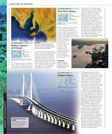
BRIDGE
southern shore, as well as affected the
This bridge across the Yangtze
dispersion and dilution of pollutants
Estuary, situated very close to
around the estuary. Silt deposition in
its mouth, is 10km (6 miles)
long. It opened in 2009.
the delta is also likely to fall, reducing
the rate of new land creation.